Catalog Archive
Auction 187, Lot 156

Rare French Edition of Arrowsmith's Influential Map of the United States

"[On 4 Sheets] United States of Nth America - Carte des Etats-Unis de l'Amerique Septentrionale Copiee et Gravee sur celle d'Arrowsmith...", Tardieu, Pierre Francois

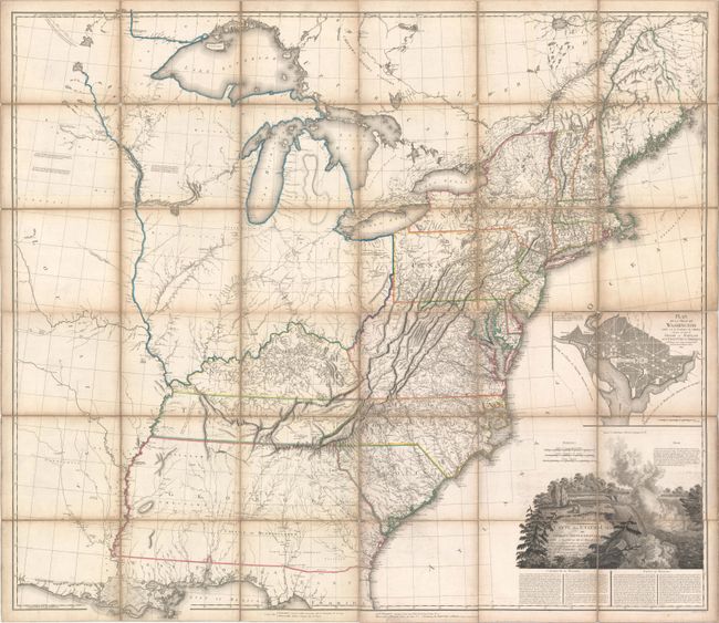
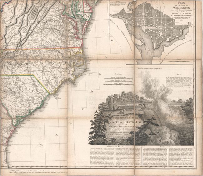
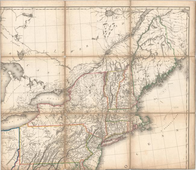
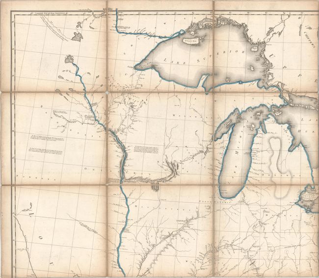
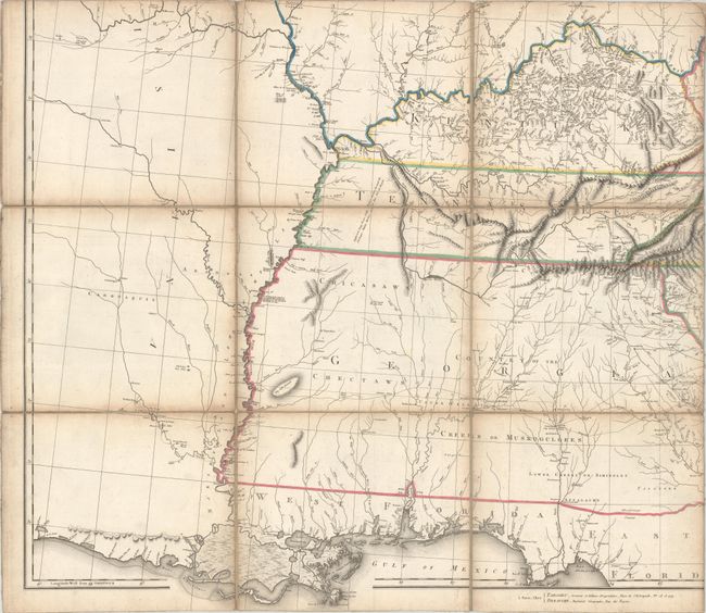
Subject: Eastern United States

Period: 1802 (dated)

Publication:

Color: Hand Color

Size:
55.2 x 49.2 inches
140.2 x 125 cm
Download High Resolution Image
(or just click on image to launch the Zoom viewer)

This is a French edition of Aaron Arrowsmith Sr.'s influential map of the United States, which was first published in 1796 and is notable for being used by Lewis and Clark to plan their famous expedition. Tardieu's edition of the United States is one of the rarest and most interesting large format maps of the period, especially in this first edition. Tardieu updated and improved his edition based on new sources, which are listed in a note above the title, and added an inset plan of Washington, DC based on Ellicott's plan of the new American capital city. The beautifully engraved title cartouche features Niagara Falls, which was copied from Arrowsmith's map, and is accompanied by a fascinating description of the Falls in both French and English.

In the south, Florida is divided between East and West, and Georgia's western border is on the Mississippi River. The map is filled with numerous notations describing the land and rivers, the location of Indian tribes, paths, rivers, and more. Tardieu translated some of Arrowsmith's original notations into French, however left many notations and placenames in English. He also added new notations in both English and French based on his sources. A few of the new English notations include regions in Canada that are noted as "hunting country," "great tract of wood land" and "immense forests." Tardieu also used manuscript maps to add extensive detail above Lake Erie, Lake Ontario and along the St. Lawrence River. Tardieu was largely successful in retaining the important cartographic details from Arrowsmith's map yet adding new information and improving upon the original edition.

Each of the four sheets is dissected into 9 sections and mounted on contemporary linen, as issued. There is an old Sondley Library, Asheville, North Carolina bookplate on verso of the northeastern sheet clearly stamped "withdrawn."

References:

Condition: B+

A nice impression with contemporary outline color, light soiling and offsetting, and some toning along the folds. There are small separations in the linen along the folds. Blind stamp at bottom of each sheet from "Sondley Library Asheville N.C." with pencil notations from the library on verso of each sheet with blue "withdrawn" stamps. The first image is a composite image - the map is on four separate sheets of linen.

Estimate: $4,000 - $5,000

Sold for: $2,000

Closed on 4/27/2022

Archived