Catalog Archive
Auction 186, Lot 715

"Marruecos Espanol",

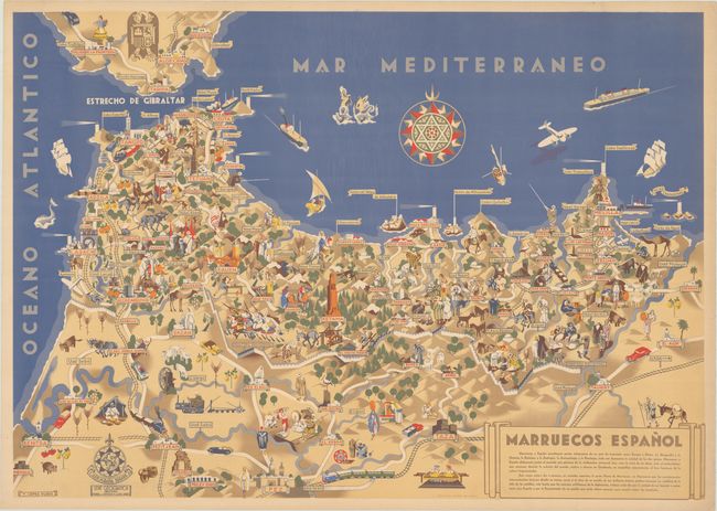
Subject: Northern Morocco

Period: 1940 (circa)

Publication:

Color: Printed Color

Size:
37.3 x 26.3 inches
94.7 x 66.8 cm
Download High Resolution Image
(or just click on image to launch the Zoom viewer)

This striking pictorial map depicts the former Spanish protectorate in northern Morocco, which was established in 1912 by a treaty between France and Spain and ceded to Morocco in 1956. The map extends south to Fes and east just shy of the border with Algeria. Key cities are labeled in bold banners, and the map is filled with small illustrations representing the people, animals, landscape, and culture of the region. Near the center of the map is the town of Ketama, symbolized with an image of the Monumento del Llano Amarillo. A white wall forms the provisional boundary between the French and Spanish colonial regions. This map was created by graphic designer Francisco Lopez Rubio (1895-1965) as part of a series of 6 pictorial maps of parts of Spain called Cartographic Hispanica. The series was published under the Serie Geografica in Barcelona by Rubio and his partner Manuel L. Ortega.

References:

Condition: A

A bold example with a hint of toning and minor creasing along the edges of the sheet.

Estimate: $400 - $475

Sold for: $300

Closed on 2/9/2022

Archived