Catalog Archive
Auction 186, Lot 661

Includes 14 Maps of Asia in Contemporary Color

"[Composite Atlas of Asia] Cartes d'Asie", Sanson/Mariette

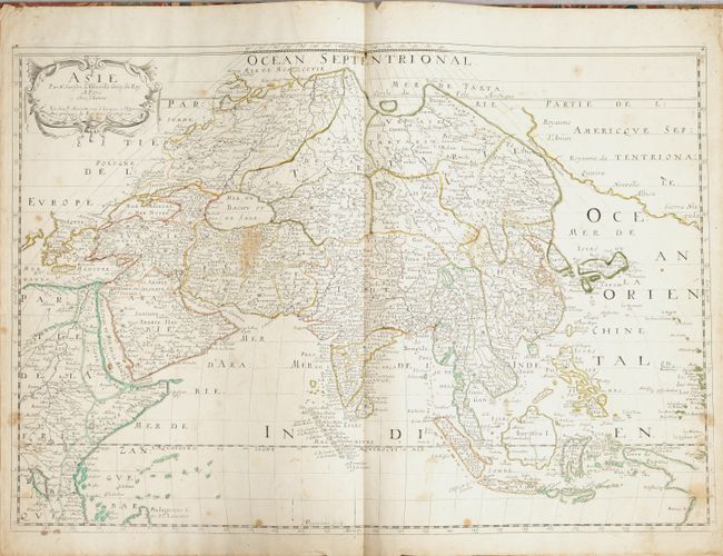
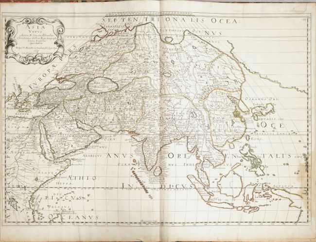
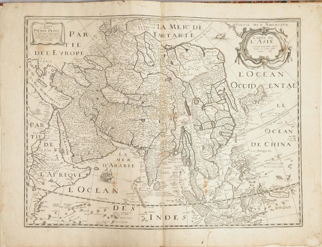
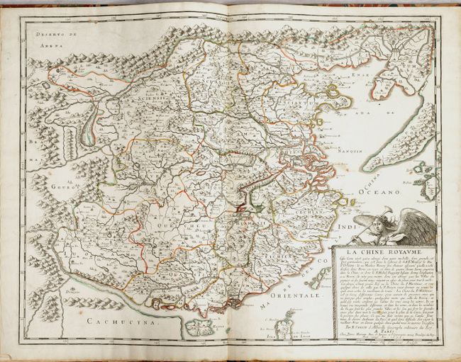
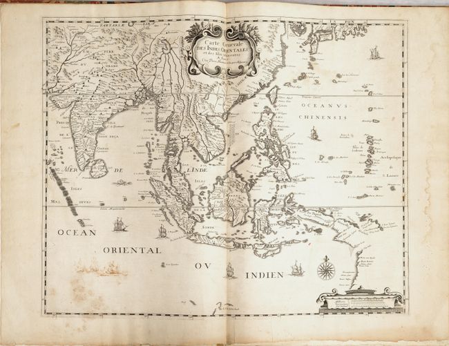
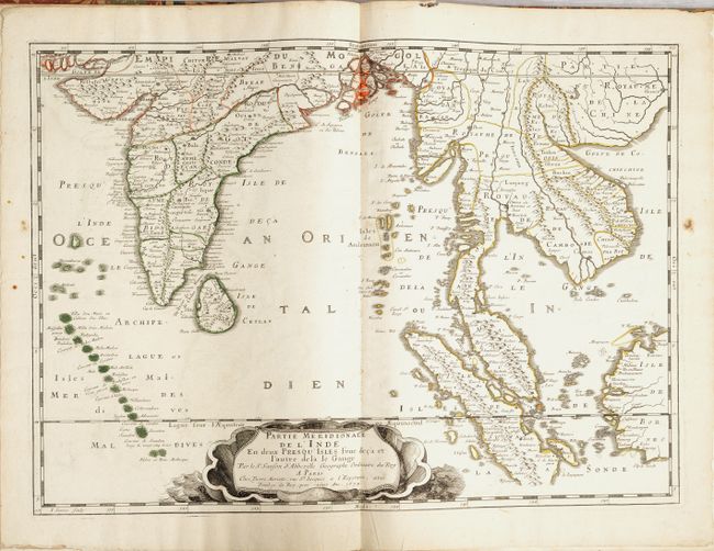
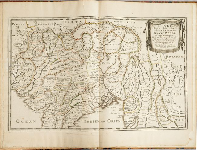
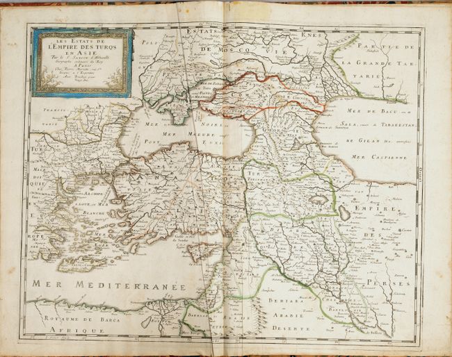
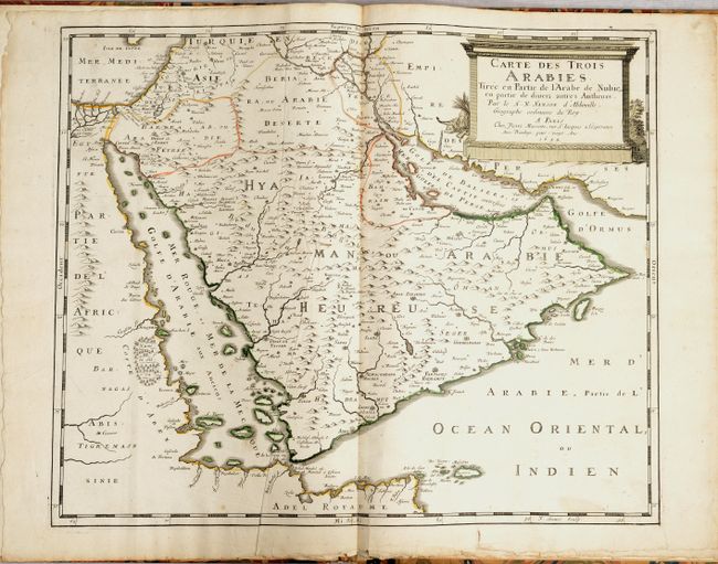
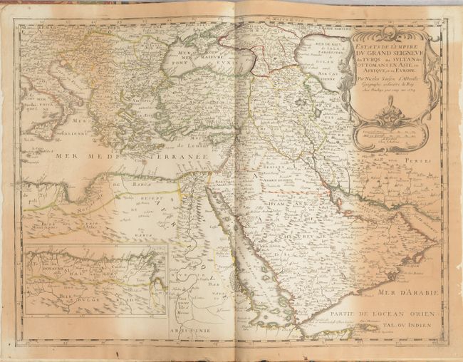
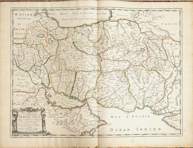
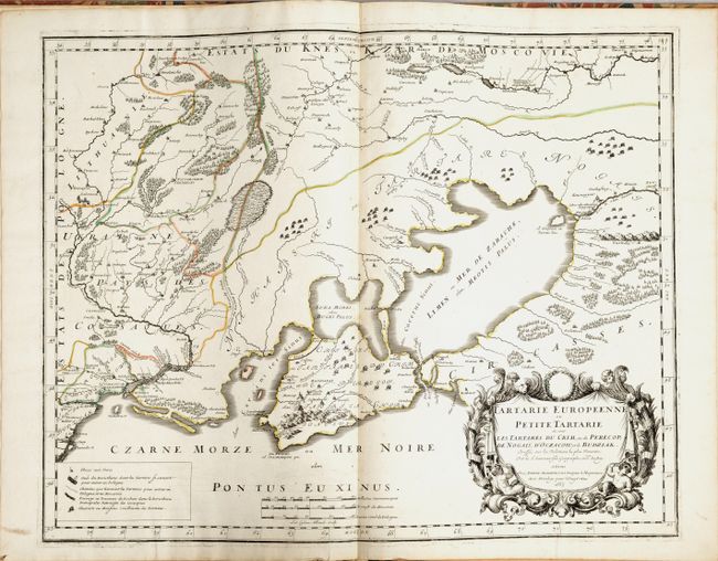
Subject: Asia, Atlas

Period: 1646-65 (dated)

Publication:

Color: Hand Color

Size:
12.4 x 17.8 inches
31.5 x 45.2 cm
Download High Resolution Image
(or just click on image to launch the Zoom viewer)

This composite atlas includes 14 maps related to Asia. Twelve of the maps are by Nicolas Sanson and Pierre Mariette, and the remaining two are by Michel van Lochom and Philippe de la Rue. As there is variation in the size of the sheets and condition of the maps, this composite atlas was likely assembled well after the publication of the maps. The maps included are:

A. Asie, by Sanson/Mariette, dated 1650. This map became the standard French map of Asia in the mid-seventeenth century. One of the more interesting features is the extensive coastline of America stretching from Royaume d'Anian to Sierra Nievada which is separated from Asia by the narrow Detroit d' Anian. The Kingdoms of Anian, Quivira and Albion are shown. Japan is shown on the Teixiera model and Korea is depicted as an island. Condition: Scattered stains. (B)

B. Asia Vetus by Sanson/Mariette, dated 1650. Cartographically, Sanson's map of ancient Asia is nearly identical to that of his modern map, although numerous place names in East Asia, Southeast Asia, and America have been omitted. Condition: A nice impression, generally clean and bright with a dampstain at bottom right. (B+)

C. Carte de l'Asie Corrigee et Augmentee, by Michel van Lochom, dated 1646, black & white. This is a very rare map that was separately issued, and is a close copy of Petrus Bertius' map of the same name, first published by Melchoir Tavernier circa 1627. Geographically, the map is a copy of Jodocus Hondius' carte-a-figures map of Asia from 1623. Condition: Scattered stains with a tear that enters 1/2" into image at bottom and has been archivally repaired on verso. (B)

D. La Chine Royaume, by Sanson/Mariette, dated 1656. This important and attractive French map of China is based on an indigenous Chinese map copied by Jesuit Matteo Ricci, and brought back to Rome in 1590 by his fellow Jesuit, Michele Ruggieri. The map extends to include the northern tip of the Philippines and a curiously curved Korean peninsula. Korea was usually shown as an island in the 17th century, so Sanson's depiction is a cartographic improvement. Condition: A nice impression on a bright sheet with light soiling and small chips in the bottom corners of the sheet. (B+)

E. Carte Generale des Indes Orientales et des Iles Adiacentes, by Pierre Mariette, black & white. Condition: There are some mildew stains at bottom left adjacent to some ships that have been added in manuscript. There is a light dampstain in the right blank margin. (B+)

F. Partie Meridionale de l'Inde en deux Presqu'Isles, by Sanson/Mariette, dated 1654. Condition: Minor offsetting with a few small paper flaws confined to the blank margins. (A)

G. L'Inde deca et dela le Gange, ou est l'Empire du Grand Mogol, by Sanson/Mariette, dated 1654. Condition: A nice bright example with a couple of short printer's creases at top and a chip at bottom right. (A)

H. Les Estats de l'Empire des Turqs en Asie, by Sanson/Mariette. Condition: Light soiling with some extraneous creasing, an archivally repaired tear that enters 1" into image at bottom, and a light stain in the top blank margin. (B)

I. Carte des Trois Arabies, by Sanson/Mariette, dated 1654. Condition: Some extraneous creasing and minor soiling at bottom. (A)

J. Estats de l'Empire du Grand Seigneur des Turqs ou Sultan des Ottomans en Asie, en Afrique, et en Europe, by Sanson, dated 1654. Condition: Heavy toning along the sides of the map with some chipping in the blank margins. (C+)

K. Description de l'Empire du Sophi des Perses, by Sanson/Mariette. Condition: A nice bright example. (A)

L. Tartarie Europeenne ou Petite Tartarie ou sont les Tartares du Crim, by Sanson/Mariette, dated 1665. Condition: A sharp impression on a bright sheet. (A)

M. Description de la Tartarie tiree en partie de plusieurs Cartes, by Sanson/Mariette, dated 1654. Condition: A nice impression with minor offsetting, a few small spots at bottom center, a stain along the border at right, and an archivally repaired chip in the bottom blank margin. (B+)

N. Sourie ou Terre Saincte Moderne, by Philippe de la Rue/Mariette. Condition: A bright sheet with one spot of soiling along the coastline near the top. (B+)

Elephant folio. No title page or list of maps was included in the atlas. Hardbound in marbled paper-covered boards with black leather label on spine with "Sanson D'Abbeville - Cartes d'Asie" in gilt.

References:

Condition:

All of the maps are in contemporary outline color except for two, noted above as black & white. The covers and spine are lightly worn with abrasions along the edges (condition: B+). See description above for the condition of each map.

Estimate: $4,750 - $6,000

Sold for: $3,500

Closed on 2/9/2022

Archived