Catalog Archive
Auction 186, Lot 401

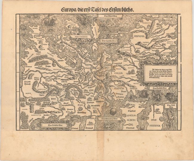
Rare Decorative Map of Europe with South Oriented to the Top

"Europa / die erst Tafel des Ersten Buchs", Stumpf, Johann

Subject: Europe

Period: 1548 (circa)

Publication: Gemeiner Loblicher Eydgnoschafft Stetten Landen und Volkeren Chronick

Color: Black & White

Size:
15.4 x 10.9 inches
39.1 x 27.7 cm
Download High Resolution Image
(or just click on image to launch the Zoom viewer)

This rare and striking woodcut map of Europe is oriented with south at the top. Although the map is a derivative of Munster's map of Europe, first published in his Cosmographia in 1544, it supersedes Munster's map with its elaborate decorations. The continent is filled with miniature bird's-eye views of towns, trees, exaggerated rivers, and rope-like mountain ranges. The ornately swirling waters are teeming with galleons and sea monsters of every variety, reminiscent of Olas Magnus' Carta Marina. At the top of the map, to the right of Sardinia, is the sea God Triton, who plays music to calm or raise the waves in the sea. The various seas are labeled in decorative cartouches.

This map was first published in Stumpf's Gemeiner Loblicher Eydgnoschafft, which was the first national atlas of Switzerland, and the first national atlas published in Europe. Twenty-three woodblock maps were included in the first edition of Stumpf's atlas, of which 10 were acquired from Honter's Rudimenta Cosmografica. The remaining 13 maps, including this map of Europe, were newly engraved for Stumpf's atlas based on the work of Waldseemuller and Munster. It is believed that Stumpf's atlas was such an excellent example of bookmaking that it incited Munster to make significant improvements to his second edition of Cosmographia.

References: Mickwitz & Miekkavaara #289-1.

Condition: B+

A sharp impression with light soiling and some toning along the centerfold. There are a pair of small wormholes in the bottom blank margin.

Estimate: $2,400 - $3,000

Sold for: $1,800

Closed on 2/9/2022

Archived