Catalog Archive
Auction 186, Lot 399

"Pascaerte van Brazil; en Nieu Neder Landt van Corvo en Flores tot de Barbados", Doncker, Henrick

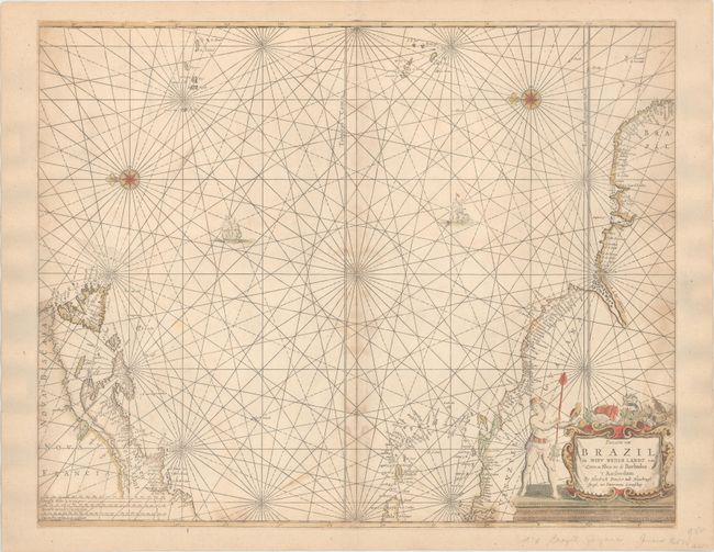
Subject: Western Atlantic Ocean

Period: 1659 (circa)

Publication: De Zee-Atlas ofte Water-Waerelt

Color: Hand Color

Size:
21.5 x 17.1 inches
54.6 x 43.4 cm
Download High Resolution Image
(or just click on image to launch the Zoom viewer)

This is the first edition of this uncommon sea chart. It shows the area from Newfoundland to the northern coast of South America and across to the Azores and the Cape Verde islands in an unusual configuration derived from the Theunisz Jacobs chart of 1650, with north oriented to the left. Long Island is named as Gebroken lant, and New England is named as Nieu Nederlant, with no mention of the English colonial presence. The cartouche is surrounded by exotic denizens of the Americas, including a nearly nude native, armadillo, a turtle, a monkey and a parrot.

References: Burden #338.

Condition: B+

Trimmed to the neatline all around and entirely backed with old paper. There is light staining along the centerfold and the neatline at left and right.

Estimate: $700 - $850

Sold for: $350

Closed on 2/9/2022

Archived