Catalog Archive
Auction 186, Lot 348

NO RESERVE

"La Paz (Lower California) and Its Environs, Showing the Positions Occupied by the U.S. Troops and the Mexicans, During the Attacks in November & December, 1847", U.S. Government

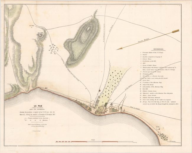
Subject: La Paz, Mexico

Period: 1848 (circa)

Publication:

Color: Hand Color

Size:
20.5 x 16.5 inches
52.1 x 41.9 cm
Download High Resolution Image
(or just click on image to launch the Zoom viewer)

This Mexican-American War map depicts the positions occupied by the U.S. Troops and the Mexicans during the attacks in November and December 1847. Roads, topography, and a bird's-eye plan of the town are illustrated. An extensive numbered key identifies numerous locations on the map. Copied by Lieutenant W.H. Warner from a survey by H. Ehrenberg, and lithographed by P.S. Duval in Philadelphia.

References:

Condition: B+

Issued folding, now pressed, with a few spots of foxing, minor staining, and minor extraneous creasing.

Estimate: $70 - $90

Sold for: $31

Closed on 2/9/2022

Archived