Catalog Archive
Auction 186, Lot 324

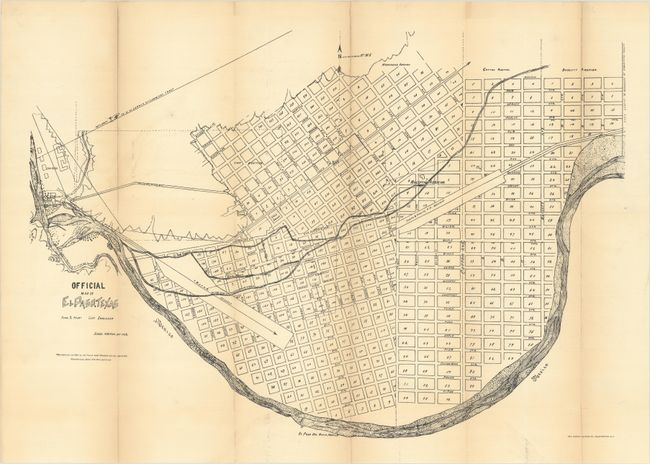
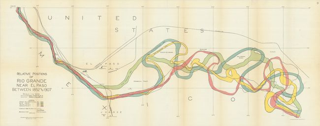
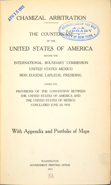
"[2 Maps with Book] Official Map Of El Paso Texas [and] Relative Positions of Rio Grande Near El Paso Between 1852 and 1907 [in] Chamizal Arbitration - The Countercase of the United States of America Before the International Boundary Commission…", U.S. Gov't Printing Office

Subject: El Paso, Texas

Period: 1911 (published)

Publication:

Color: Printed Color

Size:
6 x 9.4 inches
15.2 x 23.9 cm
Download High Resolution Image
(or just click on image to launch the Zoom viewer)

This 243-page volume examines the legal position of the United States regarding the Chamizal boundary dispute. Tensions between the United States and Mexico arose when the course of the Rio Grande River shifted away from the original 1852 survey, with both sides claiming a 600 acre tract of land between El Paso, Texas and Juarez, Mexico. The issue boiled over in 1909 when an attempt was made to assassinate Presidents Taft of the U.S. and Diaz of Mexico during their visit to the site (the dispute was not resolved until 1964!). At the rear of the volume are the following two maps:

A. Official Map Of El Paso Texas, by Juan S. Hart, black & white (22.2 x 15.1"). A detailed plan of El Paso showing the street-grid pattern of the city with individual numbered blocks. Locates lands reserved for railroads, several additions, and Fort Bliss. Lithographed by Norris Peters. Condition: Issued folding with light toning along the fold lines and numerous fold separations that have been closed on verso with archival tape. (B)

B. Relative Positions of Rio Grande Near El Paso Between 1852 and 1907, by W.W. Follett, printed color (35.6 x 13.3"). A fascinating map showing the movement of the Rio Grande over a 55-year period. It is color-coded to show four different courses, thus exposing the complicated nature of the boundary line. Condition: Issued folding on a clean sheet with a hint of toning along the fold lines. (B+)

Octavo, hardbound in blue cloth with gilt tile on the spine.

References:

Condition: B+

See description above for map condition and grades. Text is very clean and tight with an old library stamp on the title page. Covers have light wear with bumped corners.

Estimate: $200 - $230

Sold for: $60

Closed on 2/9/2022

Archived