Catalog Archive
Auction 186, Lot 299
NO RESERVE
"[Lot of 2] A Plan of the City of New York from an Actual Survey Made by James Lyne [and] Plan & Location of the Great Pier for the North River Also the Soundings of That River..."
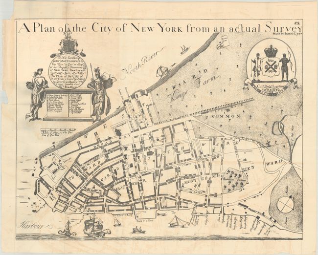
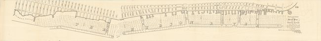
Subject: New York City, New York
Period: 1849 (circa)
Publication: Report of the Secretary of the Treasury on the Warehousing System
Color: Black & White
Size:
21.9 x 16.9 inches
55.6 x 42.9 cm
Download High Resolution Image
(or just click on image to launch the Zoom viewer)
(or just click on image to launch the Zoom viewer)