Catalog Archive
Auction 185, Lot 594

"Nieuwe Pascaart voor een Gedeelte van Barbaria Beginnende van Susa tot Caap Mesurata als mede t' Eylandt Malta", Keulen/Vooght

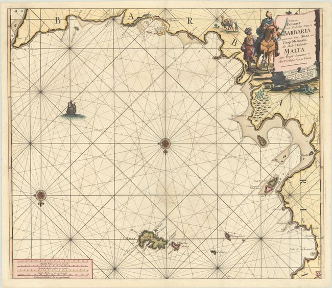
Subject: Northern Africa & Malta

Period: 1680 (circa)

Publication: De Nieuwe Groote Lichtende Zee-Fackel

Color: Hand Color

Size:
23 x 19.9 inches
58.4 x 50.5 cm
Download High Resolution Image
(or just click on image to launch the Zoom viewer)

Interesting sea chart of portions of the Tunisian and Libyan coasts from Hammamet (just south of Tunis), Tunisia to Misratah, Libya. The city of Tripoli is prominently depicted. The map is embellished with rhumb lines throughout and is oriented with north and the Mediterranean at the bottom, extending as far north as Malta. Decorated with two compass roses and a sailing ship. A large title cartouche features a man on horseback with a sword, with another man herding a camel in the background.

References:

Condition: B

A sharp impression on paper with a "P" watermark and a 1.75" chip near the center that has been professionally repaired, with the rhumb lines skillfully replaced in facsimile.

Estimate: $200 - $230

Sold for: $120

Closed on 11/17/2021

Archived