Catalog Archive
Auction 184, Lot 90

"Carte d'Amerique Divisees en ses Principales Parties…", Delisle/Covens & Mortier

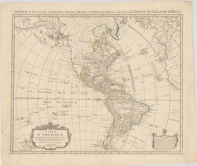
Subject: Western Hemisphere - America

Period: 1774 (dated)

Publication:

Color: Hand Color

Size:
23.8 x 19.3 inches
60.5 x 49 cm
Download High Resolution Image
(or just click on image to launch the Zoom viewer)

This map depicts a fascinating stage in the cartographic history of the American Northwest. It is based on Guillaume Delisle’s cartography (1722) amended to show the reported Russian discoveries in the Northwest. A large group of islands is shown in the approximate location of Alaska. The map also includes some fascinating and erroneous features. A large Mer de l’Ouest (Sea of the West) is depicted north of Cap Blanc. There are still remnants of the long sought Northwest Passage through a system of rivers and lakes and the famed R. de l' Ouest, which is linked by dotted line to the Sea of the West. There are also improvements and additions to the islands in the Pacific and the two islands of New Zealand appear to the left of the decorative title cartouche. This is the second state, dated 1774.

References: McGuirk #153; Tooley (Amer) p. 17, #20.

Condition: B+

Contemporary outline color on paper with a "C&I Honig" watermark, with several small, faint dampstains in the image and a larger dampstain at bottom left.

Estimate: $700 - $850

Sold for: $400

Closed on 9/15/2021

Archived