Catalog Archive
Auction 184, Lot 793

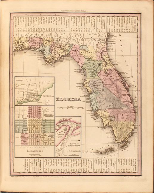
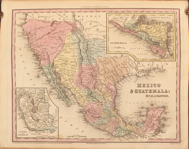
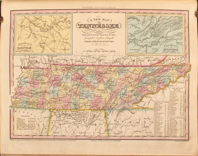
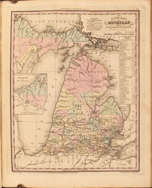
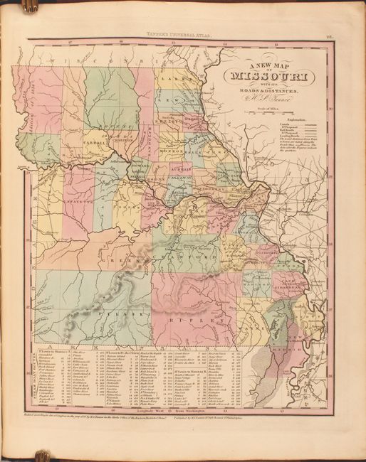
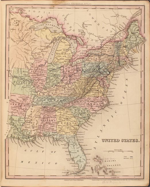
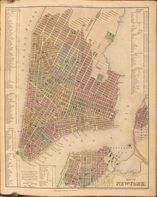
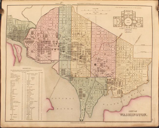
Uncommon American Edition of Tanner's Atlas

"A New American Atlas, Containing a Series of Maps of the Various Countries of North and South America, West Indies, &c...", Tanner, Henry Schenck
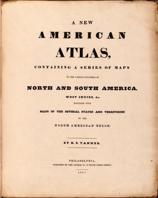
Subject: Atlases

Period: 1837 (published)

Publication:

Color: Hand Color

Size:
13 x 16.3 inches
33 x 41.4 cm
Download High Resolution Image
(or just click on image to launch the Zoom viewer)

This is the complete, American edition of Tanner's atlas, using maps from his New Universal Atlas. This complete example contains a total of 39 single-page maps, with 33 maps dedicated to North America, including city plans of New York, Philadelphia and Washington, and the balance featuring the world and South America. The American maps are dated 1833-36 and most of the non-American maps are undated. The atlas concludes with the thematic Heights of the Principle Mountains in the World.

Of particular interest is the map of the Southwest entitled Mexico & Guatemala, which shows Texas as still a part of Mexico with Austins Colony noted. Sonora extends north into present-day Utah and is wedged between New Mexico and Upper California. The rivers Timpanogos and San Buenaventura run straight through the Great Basin into the Pacific. Insets include the Valley of Mexico and Guatemala. The map presents a great picture of the region prior to Texas declaring its independence.

Also of interest is the map of Florida, which depicts a large Indian Reservation in the center of the peninsula and is marked by an Indian Boundary Line to the west and south and an Unidentified Indian Boundary Line to the east. Several land grants are also noted, including those of Arredondo, Miranda, Delespine, and Fleming, which had been granted by the Spanish government prior to ceding the territory of Florida to the United States in 1821. Other notable maps include Tennessee, Louisiana, Missouri, and Michigan.

Contents include a title page, table of contents, maps and plans. Rebacked in quarter leather and tips over original tan cloth boards with original black leather title label with gilt design on front cover.

Henry Schenck Tanner was one of the principal figures during the American "Golden Age of Cartography" (1820-40). His New Universal Atlas set the standard and his work enjoyed lasting commercial success as the publishing rights were bought by Carey & Hart from 1843-45, Samuel Augustus Mitchell from 1846-50, Thomas, Cowperthwait & Company from 1850-55, and Charles Desilver from 1856-58.

References:

Condition: B+

Maps are in excellent condition with full contemporary color, minor toning, and occasional soiling. There is a dampstain in the top right corner of the beginning of the atlas, affecting the title page, list of maps, and maps of the world and North America. The world map is more moderately toned and the chart of mountains and rivers has chips along the fore-edge that have been professionally repaired. The title page and list of maps are more heavily soiled and foxed, with small chips along the edges of the sheet. The binding is sound, the new spine has minor wear, and the original covers are heavily worn and stained.

Estimate: $3,750 - $4,500

Sold for: $3,250

Closed on 9/15/2021

Archived