Catalog Archive
Auction 184, Lot 730

"Target Tokyo [on verso] Newsmap Monday, October 18, 1943...", U.S. War Department

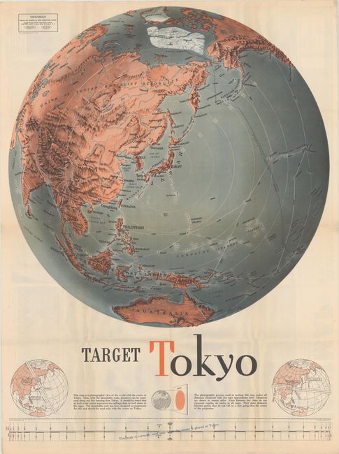
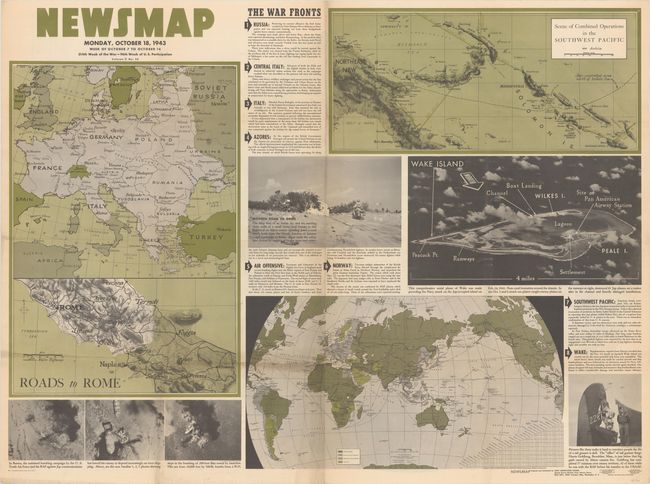
Subject: Pacific Ocean, World War II

Period: 1943 (dated)

Publication:

Color: Printed Color

Size:
34 x 45 inches
86.4 x 114.3 cm
Download High Resolution Image
(or just click on image to launch the Zoom viewer)

This impressive piece of World War II-era persuasive cartography centers on Tokyo, Japan. The "photographic map" stretches from Scandinavia and Russia through Asia and across the Bering Strait to show Alaska and the west coast of North America down to San Francisco. The map also extends to include Australia, a large polar ice cap, and Greenland. A detachable scale at bottom can be used to measure distances along any line running through Tokyo; two helpful diagrams at bottom demonstrate how to use it. Despite the map's title, at the time of the map's publication, there had been relatively few bombing raids on Japan aside from the 1942 Doolittle Raid. The heaviest strategic bombing campaigns on Japan came after the introduction of the B-29 Superfortress bomber in 1944. Drawn by F.E. Manning.

The map is one of the "newsmaps" published by the U.S. Army from 1942-46. These maps were designed to keep American troops updated on the war. The weekly posters were distributed and posted in every American installation in the world and were intentionally more visual than descriptive to help engage and motivate personnel.

See also lot 447 for a very similar map centered on Berlin.

References:

Condition: A

Issued folding with just a hint of soiling, tiny separations along the folds, and small pinholes in the top corners.

Estimate: $500 - $650

Sold for: $400

Closed on 9/15/2021

Archived