Catalog Archive
Auction 184, Lot 507

"Germania", Ortelius, Abraham

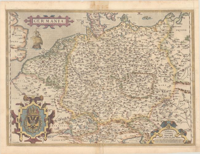
Subject: Central Europe, Germany

Period: 1572 (circa)

Publication: Theatrum Orbis Terrarum

Color: Hand Color

Size:
19.9 x 14.3 inches
50.5 x 36.3 cm
Download High Resolution Image
(or just click on image to launch the Zoom viewer)

Elegant map of the German Empire, which at the time included the Netherlands and Belgium, stretching from Calais to the Wista River in present day Poland, and south to the Adriatic Sea. Ortelius based this beautiful map on Christiaan Sgrothen's map of 1565. The title is enclosed is a strapwork cartouche, below which sails a large ship, and two large cartouches incorporate the royal coat of arms and scale of miles. French text on verso, published 1572-74.

References: Van den Broecke #56.

Condition: B+

On paper with a bunch of grapes watermark, light soiling, and a few small worm tracks in the map image, two of which have been closed on verso with archival materials. There are some stains along the centerfold at top and bottom, almost entirely confined to the blank margins.

Estimate: $350 - $425

Sold for: $250

Closed on 9/15/2021

Archived