Catalog Archive
Auction 184, Lot 137

Scarce and Desirable Early Hennepin Variant

"Le Cours du Fleuve Missisipi, Selon les Relations les Plus Modernes", Bernard, Jean Frederic

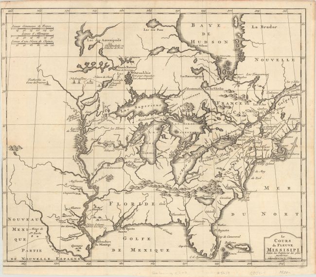
Subject: Colonial Eastern United States & Canada, Great Lakes

Period: 1737 (dated)

Publication: Recueil de Voiages au Nord

Color: Black & White

Size:
17.3 x 14.6 inches
43.9 x 37.1 cm
Download High Resolution Image
(or just click on image to launch the Zoom viewer)

This early map is based upon Louis Hennepin's seminal map of the Mississippi River and the Great Lakes. Hennepin's map presented a marked improvement on Sanson's depiction of the lake routes into the interior and the Great Lakes region, particularly the delineation of Lakes Superior, Michigan and Huron. Even with these improvements, the lack of accuracy is very evident; depicting the lakes enlarged and exaggerated, Hudson Bay too far to the east and the Mississippi River too far to the west with its mouth in what is present day Texas. The spurious lake described by LeMoyne is depicted just south of the Appalachians. A number of early settlements and Indian Tribes are shown around the Great Lakes and along the Mississippi and this map has been updated to show the location of New Orleans.

References: McCorkle #737.1; Goss (NA) #46.

Condition: B+

A sharp impression on a bright sheet, issued folding with partial loss of neatline at left due to the binding trim.

Estimate: $1,600 - $1,900

Sold for: $1,200

Closed on 9/15/2021

Archived