Catalog Archive
Auction 183, Lot 56

"America Secondo le Ultime Osservazioni dell' Accademia Reale delle Scinze", Buffier, Claude

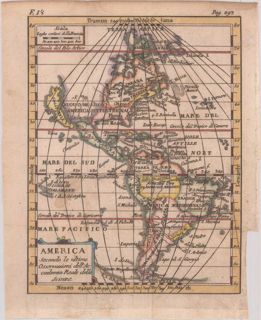
Subject: Western Hemisphere - America

Period: 1790 (circa)

Publication:

Color: Hand Color

Size:
5.3 x 6.8 inches
13.5 x 17.3 cm
Download High Resolution Image
(or just click on image to launch the Zoom viewer)

This uncommon small map of the Americas features a prominent island of California with an indented northern coastline. McLaughlin records 18 states of this map, the first of which was a French edition published in 1730 and engraved by Denise Macquart. This state is not recorded by McLaughlin, but is most similar to state 16, with Scienze changed to Scinze in the title and the page numbers "F. 18" and "Pag. 293" above the upper neatline. North America is divided between Florida, Nuouo Messico, and Canada Francia, with the British colonies squeezed along the eastern seaboard. There are a few names along the East Coast, including Tamestown (Jamestown), Irginia (Virginia), Oston (Boston), N. Yorck, and N. Inghilterra. Curiously, Boston appears to the south of New York. Caricston (Charleston) and S. Agostino are identified in Florida. The Great Lakes appear as a large blob with one stray disconnected lake to the north of the Ohio River. Santa Fe is located in Nuovo Messico. The northwestern coastline of North America is incomplete. South of Tierra del Fuego is Terra Australe. Isole di Salamone and a small stretch of coastline labeled Zelanda are shown in the Pacific.

References: McLaughlin #71.

Condition: B

A crisp impression, issued folding with dampstains at left and in the upper margin, some light scattered foxing, minor extraneous creasing, and a tiny split at one of the fold intersections. There is a binding trim and an associated tear in the left blank margin that has been closed on verso with tape.

Estimate: $200 - $230

Sold for: $275

Closed on 6/9/2021

Archived