Catalog Archive
Auction 183, Lot 55

"L'Amerique Divisee en ses Principaux Etats Assujettie aux Observations Astronomiqes", Janvier/Santini

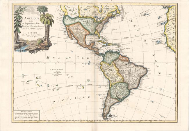
Subject: Western Hemisphere - America

Period: 1776 (circa)

Publication: Atlas Universel...

Color: Hand Color

Size:
25 x 18.2 inches
63.5 x 46.2 cm
Download High Resolution Image
(or just click on image to launch the Zoom viewer)

This large, handsome map of North and South America is an Italian edition of Janvier's map. Its most striking feature is the huge Sea of the West, which extends out of the top border, and is connected by a series of rivers to Hudson Bay in the north and nearly connects to the Mississippi River in the south. The large decorative title cartouche shows a stream filled with unusual beaver dams and a pine tree on one bank and palm trees and a native's headdress and quiver on the other. This is the first state, published by Francesco Santini.

References: McGuirk #162; Phillips (Atlases) #647-43.

Condition: A

On a bright sheet of watermarked paper with a bit of faint toning and offsetting along the centerfold.

Estimate: $500 - $650

Sold for: $375

Closed on 6/9/2021

Archived