Catalog Archive
Auction 183, Lot 405
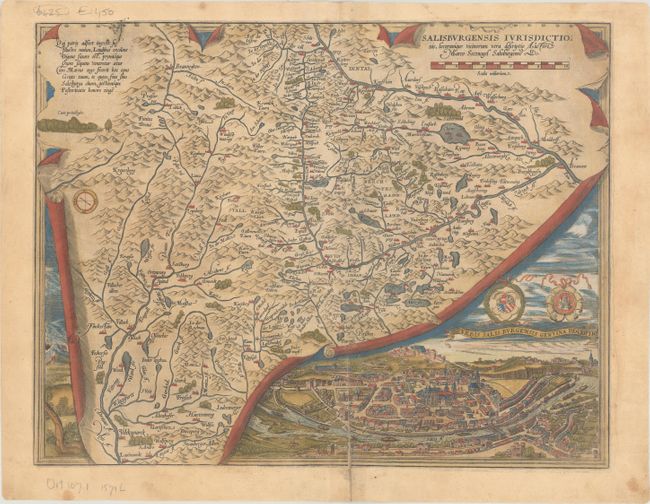
"Salisburgensis Iurisdictionis, Locorumque Vicinorum Vera Descriptio Auctore Marco Secznagel Salisburgense", Ortelius, Abraham
Subject: Western Austria
Period: 1571 (published)
Publication: Theatrum Orbis Terrarum
Color: Hand Color
Size:
17.1 x 13.3 inches
43.4 x 33.8 cm
Download High Resolution Image
(or just click on image to launch the Zoom viewer)
(or just click on image to launch the Zoom viewer)