Catalog Archive
Auction 183, Lot 329

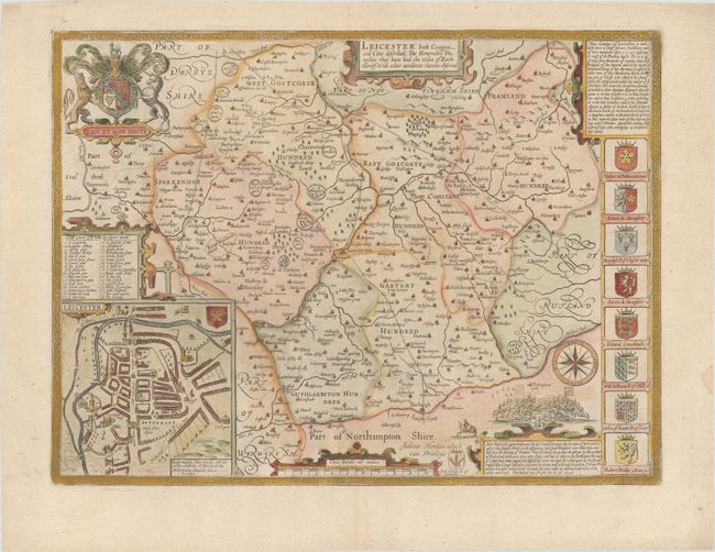
"Leicester Both Countye and Citie Described, the Honorable Famylies That Have Had the Titles of Earls Thereof. With Other Accidents Therein Observed", Speed, John

Subject: Central England

Period: 1754 (circa)

Publication:

Color: Hand Color

Size:
20.1 x 15 inches
51.1 x 38.1 cm
Download High Resolution Image
(or just click on image to launch the Zoom viewer)

This classic decorative county map of Leicestershire is from John Speed’s important English atlas. It divides the county into its hundreds and shows towns and cities, parks, hills, rivers, and more. Besides presenting the most up-to-date information in his maps, Speed also included detailed city plans; this map includes a plan of Leicester complete with the city's coat of arms and a key indicating places of interest. A vignette of the Battle of Bosworth, a battle fought on 22 August 1485 between the Houses of York and Lancaster during the Wars of the Roses, appears at bottom right with a note describing the fighting and how King Richard III was slain and then "layd all neked upon an horse, and trussed like a hogge." The map also includes a title cartouche, the royal coat of arms of the United Kingdom and the arms of several important families of Leicestershire. Engraved by Jodocus Hondius. Published by Cluer Dicey. Blank verso.

References: cf. Shirley (BL Atlases) T.SPE-1b.

Condition: A

A nice example on a bright sheet with minor marginal soiling.

Estimate: $275 - $350

Sold for: $325

Closed on 6/9/2021

Archived