Catalog Archive
Auction 183, Lot 289

NO RESERVE

"Le Perou et le Cours de la Rivre. Amazone", Sanson, Nicolas

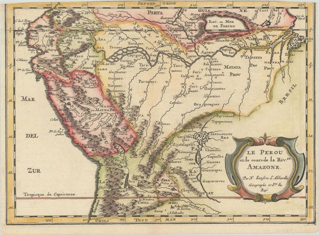
Subject: Peru & Amazon River

Period: 1700 (circa)

Publication:

Color: Hand Color

Size:
11 x 7.9 inches
27.9 x 20.1 cm
Download High Resolution Image
(or just click on image to launch the Zoom viewer)

This handsome map covers the western part of the continent and the full course of the Amazon. The spurious Lac, ou Mer de Parime is prominent as is the location of the mythical city Manoa el Dorado (city of gold). The map is fully engraved to show topography, cities, and villages and is decorated with an attractive strapwork title cartouche. Although his imprint does not appear on this map, this map was re-engraved from Sanson's 1657 map by Antoine de Winter.

Sanson's small maps from his L'Amerique en Plusieurs Cartes..., first published in 1657 and engraved by A. Peyrounin, were copied several times by various map publishers. Johann David Zunners made copies of Sanson's maps for his German translation of Die Gantze Erd-Kugel in 1679. Johannes Ribbius and Simon de Vries published copies in 1682 and 1683, with new maps engraved by Antoine d'Winter. The plates were later sold to Francois Halma, who used them in 1699 and then again in 1705 with the titles re-engraved in Dutch. The titles on the d'Winter plates were re-engraved back into French, and then used by Nicholas Chemereau in 1715 and by Henri du Sauzet in 1738.

References: Pastoureau, SANSON II F bis.

Condition: B

A crisp impression with minor offsetting and toning, trimmed at top with partial loss of neatline.

Estimate: $100 - $130

Sold for: $80

Closed on 6/9/2021

Archived