Catalog Archive
Auction 183, Lot 129

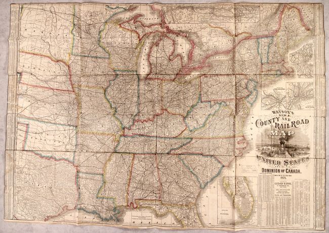
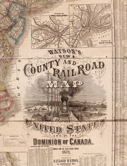
"Watson's New County and Railroad Map of the United States and of the Dominion of Canada", Watson, Gaylord

Subject: Eastern United States, Railroads

Period: 1871 (dated)

Publication:

Color: Hand Color

Size:
52 x 36.5 inches
132.1 x 92.7 cm
Download High Resolution Image
(or just click on image to launch the Zoom viewer)

A highly detailed wax-engraved map of the eastern United States stretching from the Atlantic seaboard to the Great Plains. Depicts the well-developed railroad network in the east and the emerging lines in the west. A legend further identifies unfinished railroads, state capitals, county towns and "important places." Includes an inset of the recently completely Union Pacific Railroad at top along with insets Boston, Philadelphia, New York, and the Lower Part of Florida. The map is flanked by population statistics from the 1870 census with additional detail below the decorative title cartouche featuring a locomotive. First edition. The Rumsey reference is for the 1874 edition. Not in Modelski.

References: Phillips (Maps) p. 202; cf. Rumsey #2540.

Condition: B

Issued folding and trimmed to the neatline at left, right and top with some light dampstaining and old tape stains along the sheet edges. There are a number of small fold separations mostly at the junctions with minute loss. Several small tears and stains along the left border where the map was previously adhered to a board have been rudimentarily repaired on verso.

Estimate: $800 - $950

Sold for: $1,100

Closed on 6/9/2021

Archived