Catalog Archive
Auction 182, Lot 95

"A New & Accurate Map of North America; with the New Discovered Islands on the North East Coast of Asia", Bowen, Thomas

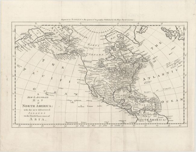
Subject: North America

Period: 1787 (circa)

Publication: A New Royal Authentic and Complete System of Universal Geography

Color: Black & White

Size:
17.1 x 10.3 inches
43.4 x 26.2 cm
Download High Resolution Image
(or just click on image to launch the Zoom viewer)

This is the first state of this map of North America focusing on the discoveries of Captain Cook in the Pacific Northwest and Alaska. Alaska is fairly well formed, although much of the Aleutian Island chain is depicted as a peninsula. Northern Canada is marked Parts Unknown, and northern California is New Albion. The northeast coast of Asia is depicted with a well formed Kamtschatka Peninsula. New Mexico encompasses present-day Louisiana and Texas, while the eastern seaboard states all extend to the Mississippi River. On the continent, the political divisions are delineated by dotted lines, and numerous Indian nations are located. Although there is no engraver's signature, Thomas Bowen is known to have prepared the maps for Bankes's New System of Geography.

References: McCorkle (18th C. Geography Books) #11-8; Shirley (BL Atlases) T.BANK-1a #8.

Condition: A

A crisp impression issued folding, now flat, with minor extraneous creasing.

Estimate: $275 - $350

Sold for: $200

Closed on 4/28/2021

Archived