Catalog Archive
Auction 182, Lot 795

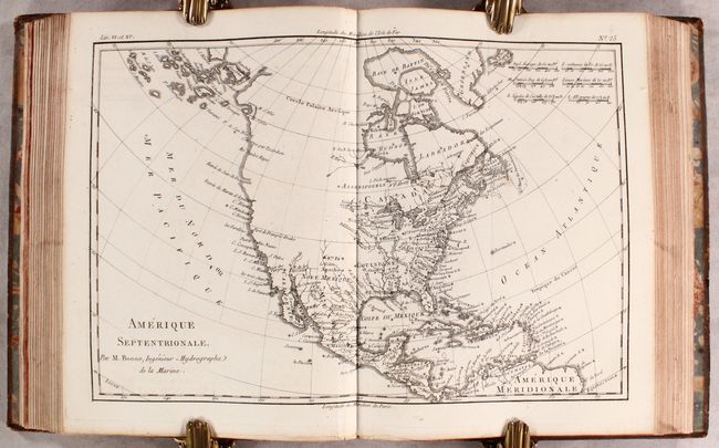
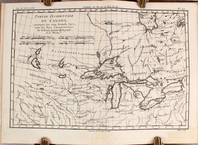
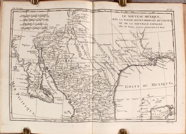
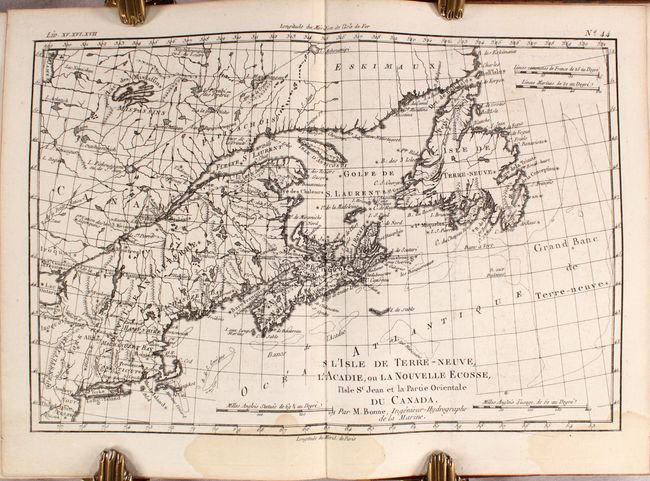
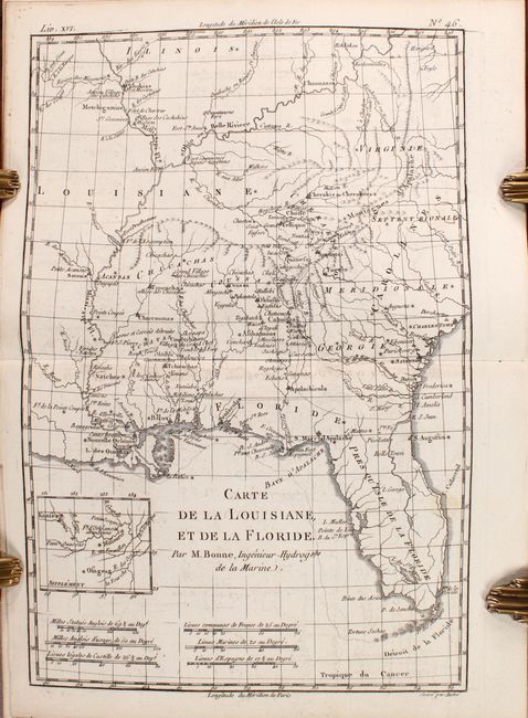
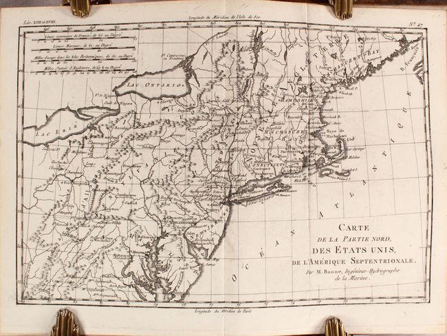
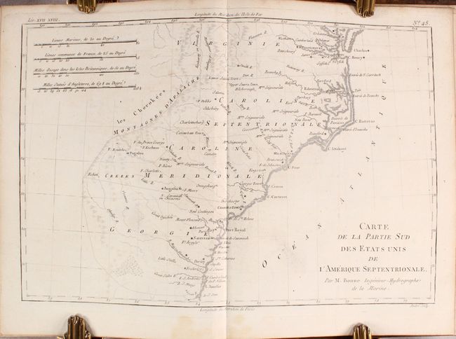
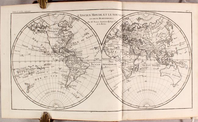
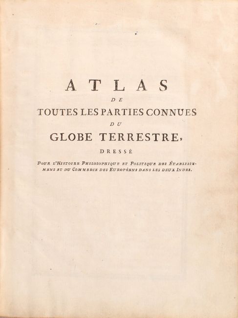
"Atlas de Toutes les Parties Connues du Globe Terrestre, Dresse pour l'Histoire Philosophique & Politique des Etablissemens & du Commerce des Europeens dans les Deux Indes", Bonne/Raynal

Subject: Atlases

Period: 1780 (circa)

Publication:

Color: Black & White

Size:
8 x 10.4 inches
20.3 x 26.4 cm
Download High Resolution Image
(or just click on image to launch the Zoom viewer)

This is the atlas volume for Abbe Raynal's L'Histoire Philosophique et Politique des Etablissemens et du Commerce des Europeens dans les Deux Indes. The atlas is complete and is filled with Bonne's well-drawn maps and charts engraved by Andre. Included are a list of maps, Analyse Succincet de l'Atlas (28 pages), and 50 maps. The map contents include two world maps, North America, South America, Europe, Asia, and Africa. There are also regional maps, including nine related to Europe, eight related to Africa, eight related to Asia, six related to South America, and fifteen related to North America. The notable North American regional maps are: Partie Occidentale du Canada; Le Nouveau Mexique; L'Isle de Terre-Neuve, l'Acadie; Carte de la Louisiane, et de la Floride; Carte de la Partie Nord des Etats Unis; and Carte de la Partie Sud des Etats Unis.

In the map of North America, the entire western part of the continent is left mostly blank. Indian tribes, such as the Apaches, Sioux, Outagamis, and Assenipouels, occupy the edges of defined territory. The British Colonies and a few major cities are named along the eastern seaboard and in the Great Lakes region. Alaska is shown as a group of islands, the largest of which is labeled Alaschka.

Hardbound in full mottled leather with gilt tooling and titling on spine and marbled endpapers. The atlas volume did not carry any publication information on the title page, but was known to be published in 1780.

References: Shirley (BL Atlases) T.BONN-3b.

Condition: B+

The maps are generally clean and bright with dark impression, light printer's ink residue, and an occasional spot of foxing or soiling. There are dampstains affecting about 10 maps at the end of the volume, confined to the blank margins with the exception of the maps of the Lesser Antilles, New England, Northwestern Africa, and Martinique. The map of Martinique is the only one in the volume that has light toning. A few maps have a small portion of the blank margin trimmed away. A previous owner's signature is on the front free-endpaper. The covers and spine are worn with bumped corners and the covers are beginning to detach from the spine.

Estimate: $1,200 - $1,500

Sold for: $1,000

Closed on 4/28/2021

Archived