Catalog Archive
Auction 182, Lot 642

"Palestinae sive Totius Terrae Promissionis Nova Descriptio Auctore Tilemano Stelia Sigenens", Ortelius/Galle
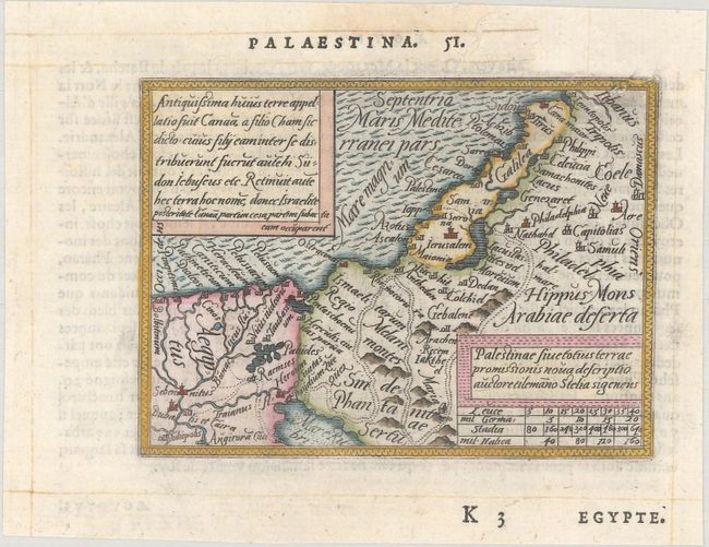
Subject: Holy Land

Period: 1579 (published)

Publication: Le Miroir du Monde

Color: Hand Color

Size:
4.2 x 3.1 inches
10.7 x 7.9 cm
Download High Resolution Image
(or just click on image to launch the Zoom viewer)

This is a miniature version of Ortelius' modern map of the Holy Land. It shows the path of the Children of Israel through the wilderness and a few major cities. French text on verso.

This map is from the first pocket-sized atlas, Spieghel der Wereld, which was based on Ortelius' Theatrum Orbis Terrarum. The maps were engraved on copper by Filips Galle and represented all regions around the world. The maps were accompanied by text prepared by Peter Heyns, who used the text from the Theatrum. The numbers printed above the maps, adjacent to the letterpress title, indicate the number of the map within the Theatrum. This innovative, small atlas was designed to reach the lower middle class, and was a commercial success, prompting numerous reprints and imitations. The first edition of the Spieghel der Wereld was published in 1577, with subsequent editions published in French in 1579 and 1583, Dutch in 1583 and 1596, and Latin in 1585. One unique feature of this pocket atlas was the inclusion of 6 larger, fold-out maps of the world, Europe, France, Germania, the Low Countries and Italy that were included alongside 66 miniature maps.

References: King (2nd Ed.) pp. 60-61; Van der Krogt (Vol. III) #8150:331.

Condition: A

A crisp impression on a bright sheet with a chip and some worm tracks at top right that have been professionally repaired with old paper on verso, with minute loss of the border at top right.

Estimate: $140 - $170

Sold for: $170

Closed on 4/28/2021

Archived