Catalog Archive
Auction 182, Lot 569

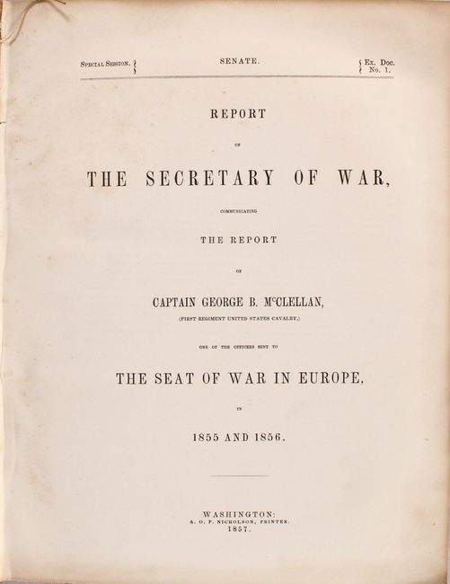
"Sevastopol, Shewing the Russian Defence Works and the Approaches of the Allied Armies [with report] Report of the Secretary of War, Communicating the Report of Captain George B. McClellan...", U.S. War Department

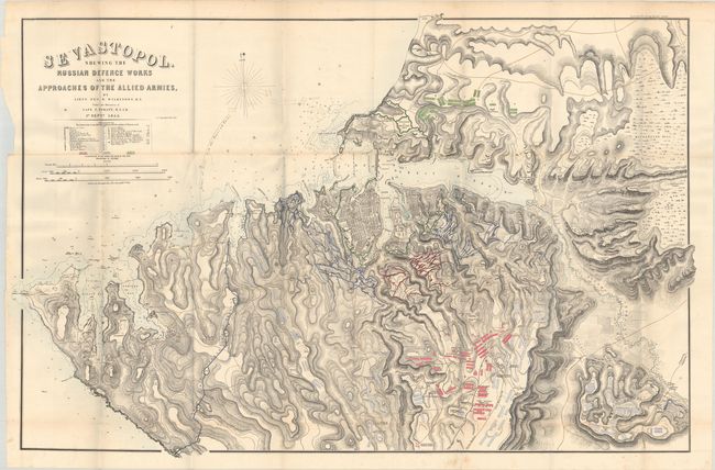
Subject: Black Sea, Crimea

Period: 1857 (published)

Publication: Sen. Ex. Doc. 1, 34th Congress, Special Session

Color: Hand Color

Size:
46.1 x 30.3 inches
117.1 x 77 cm
Download High Resolution Image
(or just click on image to launch the Zoom viewer)

This striking map shows the positions of Russian troops (in green) and English and French troops (in red and blue) around the city of Sevastopol during the Crimean War. Sevastopol was a pivotal battleground as it was a critical port in the Black Sea. Details include the street layout of Sevastopol, numerous forts, artillery placements, and well-developed topography. Drawn by Lieutenant George R. Wilkinson and Captain T. Spratt for the British Hydrographic Office. This edition of the map accompanies the 460-page Report of the Secretary of War, Communicating the Report of Captain George B. McClellan, One of the Officers Sent to the Seat of War in Europe. Quarto, hardbound in contemporary leather.

References:

Condition: A

Condition code is for the map, which is mostly clean and bright with a few minor spots of foxing and a chip in the left blank margin. Text is lightly toned with occasional foxing. The spine has perished and the covers are heavily worn.

Estimate: $350 - $425

Sold for: $200

Closed on 4/28/2021

Archived