Catalog Archive
Auction 182, Lot 498

NO RESERVE

"A Map of the Northern Part of France, with the Adjacent Netherlands, and the Course of the Rhine from Upper Alsace to Dusseldorf...", Faden, William

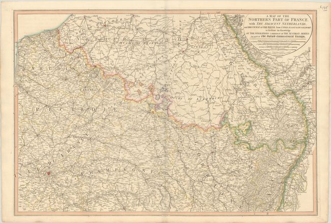
Subject: Northern France, Belgium, & Luxembourg

Period: 1795 (dated)

Publication:

Color: Hand Color

Size:
31.1 x 21.3 inches
79 x 54.1 cm
Download High Resolution Image
(or just click on image to launch the Zoom viewer)

This handsome map of the region is dense with detail including political divisions, place names, and topography. It covers Northern France and its surroundings, spanning from the Strait of Dover east to Frankfurt and from Antwerp south to Troyes. Several historical regions are identified including Flanders, Brabant, Duchy of Luxemburg, Baden, Artois, Picardy, Champagne, and Lorraine. A title cartouche at top right incorporates four distance scales. Engraved by Benjamin Baker.

References:

Condition: A

A sharp impression with full contemporary color on a sturdy sheet with an "1809" watermark and minor offsetting.

Estimate: $80 - $100

Sold for: $22

Closed on 4/28/2021

Archived