Catalog Archive
Auction 182, Lot 358

"Mexico, California, Texas, &c.", Tallis, John

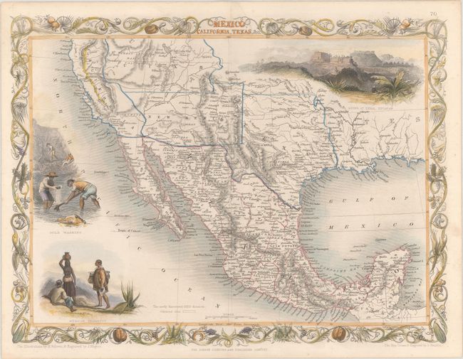
Subject: Southwestern United States & Mexico

Period: 1857 (circa)

Publication: Illustrated Atlas and Modern History of the World

Color: Hand Color

Size:
13 x 9.8 inches
33 x 24.9 cm
Download High Resolution Image
(or just click on image to launch the Zoom viewer)

The maps from The Illustrated Atlas were first published in serial form to a target audience that led insular lives due to the expense and hardship of travel. All that changed as the progress of the nineteenth century brought swift and dramatic changes in public awareness of far away places. Tallis' maps no doubt played an important role in this dramatic awakening. These maps not only provided up-to-date geographical knowledge, but also used vignette views within the map's design to show the native people and their occupations, cities and points of interest. The maps hark back to a cartographic tradition from the Dutch mapmakers of the seventeenth century with finely engraved decorative borders. The maps were drawn and engraved by John Rapkin with views drawn and engraved by a number of prominent artists. The maps were issued as a complete volume from 1851 until about 1865. Some of the maps were also published in other history books published by Tallis including British Colonies and, without the vignettes, in geographical dictionaries and encyclopedias until about 1880.

This is the very uncommon third state of this great map depicting the American Southwest and Mexico. After gold was discovered in California, the plate was re-engraved to include a vignette of gold panning and the gold regions of California were delineated through hand coloring. Two other vignettes show Mexican peasantry and the ancient Mayan ruins at Uxmal. This state of the map shows the Gadsden Purchase boundary between the United States and Mexico with the large territories of Utah and New Mexico. Texas is also shown in an unusual configuration, taking in all of present-day Oklahoma. The very decorative border incorporates agaves, squash, prickly pear cactus, and pomegranates all woven together. Map drawn and engraved by John Rapkin, vignettes drawn by H. Warren and engraved by J. Rogers.

References:

Condition: A

Contemporary outline color with later color in the decorative elements.

Estimate: $350 - $425

Sold for: $225

Closed on 4/28/2021

Archived