Catalog Archive
Auction 182, Lot 339

"Homes of the Presidents - A Historical Tour with Texaco",

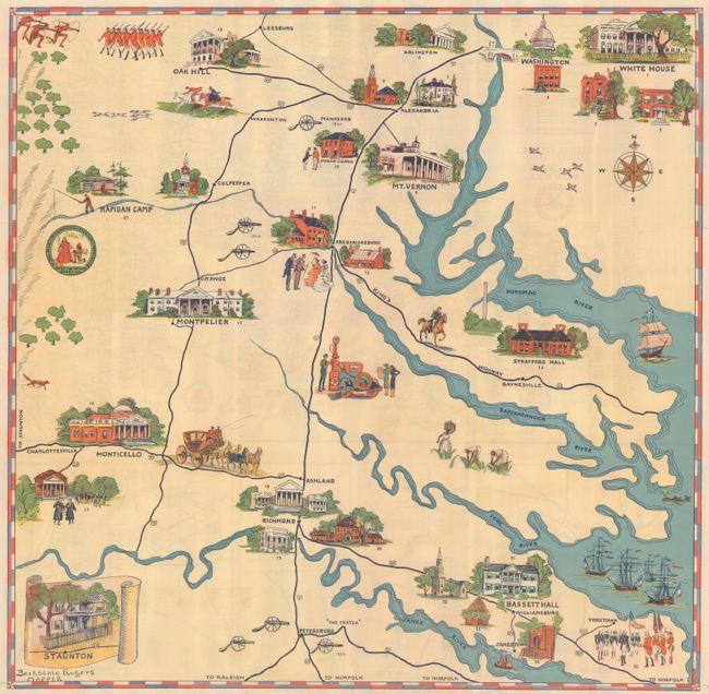
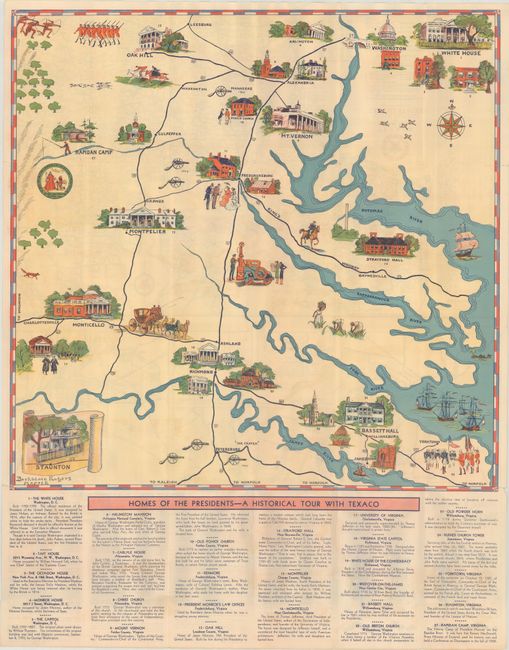
Subject: Eastern Virginia

Period: 1930 (circa)

Publication:

Color: Printed Color

Size:
21.1 x 20.7 inches
53.6 x 52.6 cm
Download High Resolution Image
(or just click on image to launch the Zoom viewer)

This pictorial map of eastern Virginia and Washington D.C. was created by Barksdale Rogers, a female artist, illustrator and sculptor. It illustrates 27 locations relating to the Presidents and early American history with a list of the sites below the map. The verso contains a Texaco road map of the Northeast with inset maps of Washington D.C. and 5 Virginia cities. The accompanying text indicates the map was intended as a souvenir: “Here is a road map that is a little unusual – and rightly so, because the area depicted is one of unusual historic interest…The completed [after shellac applied] map has a high decorative value and will be a souvenir of a thrilling tour…” Self-folding with pictorial wrappers (3.7 x 7.0").

References:

Condition: B+

Issued folding with some minor fold separations.

Estimate: $160 - $190

Sold for: $850

Closed on 4/28/2021

Archived