Catalog Archive
Auction 182, Lot 331

Earliest Published Views of the Ruins of the Alamo

"Report of the Secretary of War Communicating ... a Map Showing the Operations of the Army of the United States in Texas and the Adjacent Mexican States on the Rio Grande...", U.S. War Department

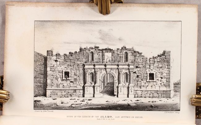
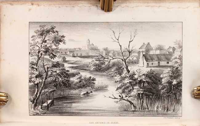
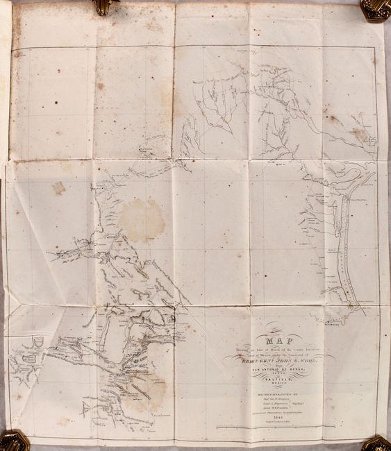
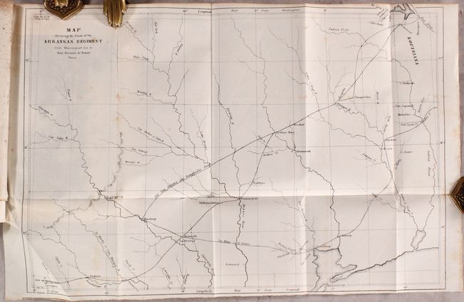
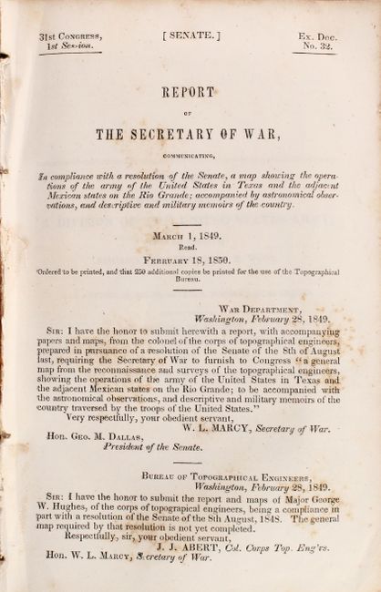
Subject: San Antonio, Texas

Period: 1850 (published)

Publication: Sen. Ex. Doc. 32, 31st Congress, 1st Session

Color: Black & White

Size:
5.8 x 8.8 inches
14.7 x 22.4 cm
Download High Resolution Image
(or just click on image to launch the Zoom viewer)

This rare report by Capt. George W. Hughes related to the Alamo is complete with two folding maps and eight lithographed plates showing early views of the Alamo, San Antonio and vicinity. Hughes served as a topographical engineer under Brigadier General John E. Wool. The plates include the first view of the Alamo to be lithographed from an eyewitness drawing, and the two earliest views of the interior and exterior of the Alamo in ruins. The maps are: Map Showing the Line of March of the Centre Division, Army of Mexico, under the Command of Brigr. Genl. John E. Wool, from San Antonio Bexar, Texas to Saltillo, Mexico…1846 (18.2 x 19.3") and Map Showing the Route of the Arkansas Regiment from Shreveport La. To San Antonio de Bexar Texas (17.0 x 11.5"). The plates include the following:

1) "San Antonio de Bexar 1846."
2) "Ruins of the Church of the Alamo, San Antonio de Bexar. Scale 10 feet to an Inch, 1850." By Everett.
3) "Interior View of the Church of the Alamo." By Everett.
4) "Plan of the Ruins of the Alamo near San Antonio de Bexar 1846." By Everett.
5) "Mission Concepcion, Near San Antonio de Bexar" By Everett.
6) "Mission of San Jose Near San Antonio de Bexar" By Everett.
7) "Church near Monclova. "
8) "Watch Tower Near Monclova."

Five of the plates, including the Alamo images, are from the watercolors drawn by the London-born artist Edward Everett (1818-1903). After coming to the United States in 1840, Everett served in the Mormon War and the Mexican-American War. He came to Texas as part of Wool’s division, which eventually made its headquarters in San Antonio where Everett made his drawings. A fascinating and historical report usually not found in this complete state.

Disbound, 67 pp., 2 maps, 8 lithographic plates.

References: Howes #H-767.

Condition: B

The first map has moderate foxing and two stains in the image, while the other map and text have scattered foxing. The accompanying plates are very good with some scattered foxing mostly in the margins.

Estimate: $800 - $950

Sold for: $1,300

Closed on 4/28/2021

Archived