Catalog Archive
Auction 182, Lot 226

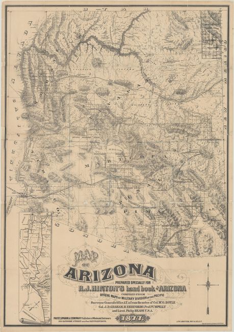
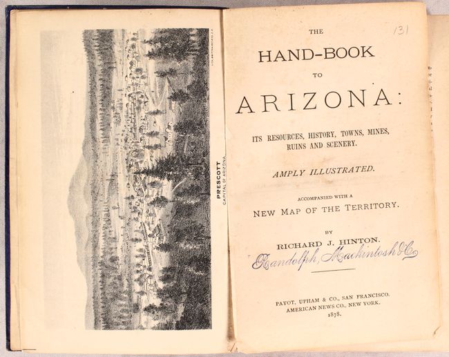
One of the Earliest Large-Scale Maps of Arizona Territory

"Map of Arizona Prepared Specially for R.J. Hinton's Hand Book of Arizona Compiled from Official Maps of Military Division of the Pacific… [with] The Hand-book to Arizona: Its Resources, History, Towns, Mines, Ruins and Scenery...", Hinton, Richard J.

Subject: Arizona

Period: 1877 (dated)

Publication:

Color: Black & White

Size:
24.1 x 34.6 inches
61.2 x 87.9 cm
Download High Resolution Image
(or just click on image to launch the Zoom viewer)

This superb lithographed map is accompanied by Hinton’s Hand-book, which is rare because the book and map were separately published. The map locates mining districts, individual mines, mills, furnaces, wells, springs, major landmarks, towns, ranches, military camps, Indian reservations, stage routes, telegraph lines, railroads, roads, and trails. The Atlantic and Pacific Railroad is shown with its land grants marked 40 Mile Limits. The Southern Pacific follows the Overland Mail Stage Route along the Gila River to Florence with a myriad network of proposed railways in the southeastern mining districts. An inset map, “Map of the Southern Pacific Railroad Connecting with the Central Pacific R.R. at Goshen 1877,” depicts the railway from San Francisco to Yuma.

The book, the earliest on mining in Arizona, provides a wealth of other information as well. It is an important overview of the territory’s newly-discovered mineral wealth and a guide for potential investors and settlers. First Edition, Payot, Upham & Co, San Francisco, 1878. 431, [2], ci appendix + 43 ad pp.; with 22 lithographed plates & 6 lithographed maps & plans (2 folding), plus numerous illustrations in text; inserted advertisement for Britton & Rey who lithographed the plates and maps. (12mo) 7 ½ x 5”, original blue cloth lettered in gilt with gilt cover vignette. Ink stamp of Randolph Mackintosh & Co. on endpapers and verso of a few plates.

References: Howes #H-513; Philips (Maps) p. 123; Streeter #525.

Condition: B

Issued folding, now flat. The map has been professionally backed in sturdy Japanese tissue to close several separations and some small areas of loss along the folds. There is a faint line in blue pencil along the Maricopa and Pima county boundaries. The text of the book is faintly toned with light scattered foxing. There is a short binding tear on one of the folding maps. Covers are rubbed and the spine is starting.

Estimate: $5,500 - $7,000

Unsold

Closed on 4/28/2021

Archived