Catalog Archive
Auction 182, Lot 175

Popple's Epic Map - Southeastern Sheet

"[A Map of the British Empire in America (Sheet 10) - Southeast Region]", Popple, Henry

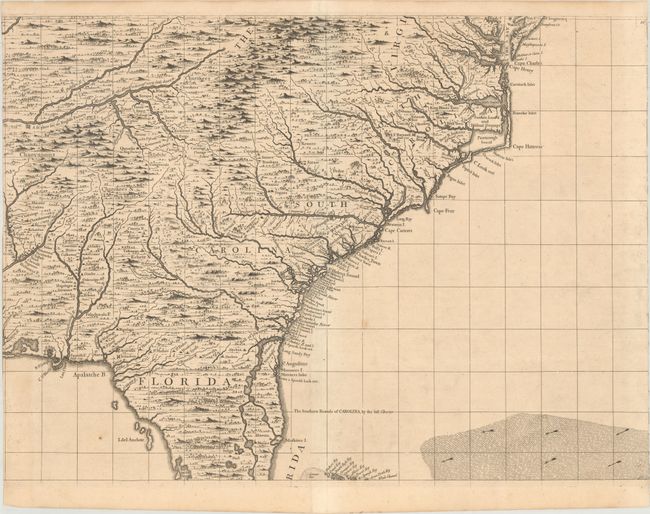
Subject: Colonial Southeast United States

Period: 1734 (circa)

Publication:

Color: Black & White

Size:
26.7 x 19.3 inches
67.8 x 49 cm
Download High Resolution Image
(or just click on image to launch the Zoom viewer)

This sheet covers the southeastern United States from the entrance to the Chesapeake Bay south to Tampa Bay (B. del Spirito Sancto) and west to Santa Rosa Bay. Popple consulted Colonel John Barnwell's manuscript map (circa 1721) of the region for much of this map including new settlements along the Carolina coastline as well as Indian villages in the interior. The map includes several interesting notations related to English establishment in the interior including "A fit Place for an English Factory" at the confluence of the Clinch and Tennessee rivers (near Kingston) and existing factories in southeastern Tennessee and western South Carolina. Overall the map presents nice detail of the settlements along the coastline while major rivers, pictorial forests, and numerous Indian tribes fill the vast interior.

Henry Popple based his epic map on firsthand information gathered over several years at the Board of Trade and Plantations. The map was the first large-scale British map to provide an overall view of the eastern half of North America. As tensions grew between the colonial powers, the map became immensely influential throughout Europe and was copied by several cartographers. Marked page 10 in the top right corner of the sheet.

References: Pritchard & Taliaferro #24; Cumming (SE) #216; McCorkle #733.1.

Condition: B

A crisp impression on a sturdy sheet with faint toning and a few spots of foxing. This example was likely previously joined with the other sheets to form the complete map as the side blank margins have been trimmed away.

Estimate: $2,000 - $2,300

Sold for: $1,500

Closed on 4/28/2021

Archived