Catalog Archive
Auction 182, Lot 155

"Etats-Unis de l'Amerique Septentrionale", Lapie, Alexander Emile & Pierre
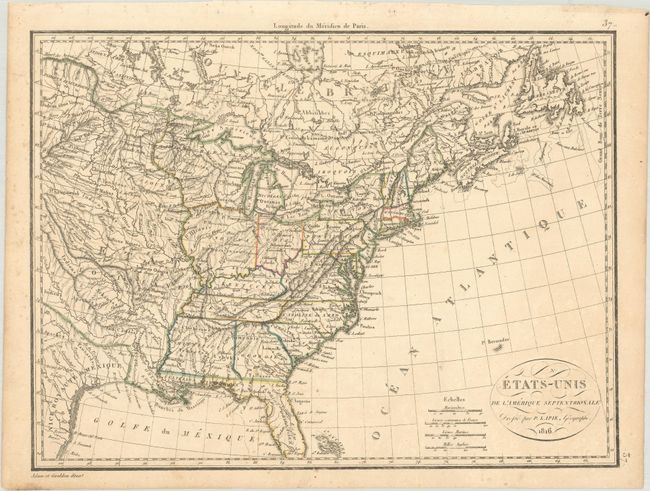
Subject: Eastern United States

Period: 1816 (dated)

Publication:

Color: Hand Color

Size:
11.7 x 8.8 inches
29.7 x 22.4 cm
Download High Resolution Image
(or just click on image to launch the Zoom viewer)

This interesting map of the United States in the first part of the 19th century features a very well mapped river system and intricate topographical detail. The map shows 17 states, with Louisiana still shown as a massive territory despite achieving statehood in 1812, four years before the date on the map. It names the territories of Mississippi, Indiana, Michigan, and Maine (Mains here). The Midwest is filled with numerous Indian tribes. Fancy titling in a small oval cartouche. Four distance scales with longitude measured only from Paris. Engraved by Adam and Giraldon.

References:

Condition: A

Minor scattered foxing mostly in the margins.

Estimate: $110 - $140

Sold for: $80

Closed on 4/28/2021

Archived