Catalog Archive
Auction 182, Lot 135

"Carte Speciale, Historique et Geographique de la Republique des Etats-Unis de l'Amerique du Nord", Renouard, Paul

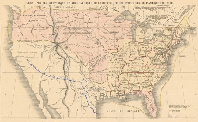
Subject: United States, Texas

Period: 1842 (circa)

Publication:

Color: Hand Color

Size:
16.9 x 10 inches
42.9 x 25.4 cm
Download High Resolution Image
(or just click on image to launch the Zoom viewer)

This interesting and unusual map comes from a French edition of Lavoisne's historical atlas. It shows 26 states in yellow extending west to Missouri, Arkansas, and Louisiana. Territories are highlighted in pink including Wisconsin, Iowa, Missouri and Oregon, which extends well north into present-day Canada reflecting U.S. interests in the region. The independent Republic of Texas is prominently depicted in a smaller configuration with Mexico in control of the Southwest. A massive mountain range dominates the west and a speculative River of the West (R. del Carmelo ou St. Philippe) flows across the Great Basin, which is labeled as parts unknown. Native American tribes are located with a notation estimating their population at 300,000. On a full sheet with French text (27 x 20.5").

References:

Condition: A

On a watermarked sheet with a hint of pleasant light toning.

Estimate: $350 - $425

Sold for: $250

Closed on 4/28/2021

Archived