Catalog Archive
Auction 182, Lot 130

"A New Map of the Province of Lower Canada, Describing All the Seigneuries, Townships, Grants of Land, &c. Compiled from Plans Deposited in the Patent Office Quebec; by Samuel Holland, Esq. Surveyor General…", Wyld, James

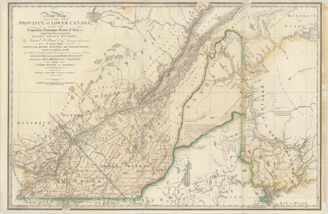
Subject: Maine & Eastern Canada

Period: 1838 (dated)

Publication: A New General Atlas of Modern Geography...

Color: Hand Color

Size:
34.2 x 22.7 inches
86.9 x 57.7 cm
Download High Resolution Image
(or just click on image to launch the Zoom viewer)

Title continues: "To Which Is Added a Plan of the Rivers, Scoudiac and Magaguadavic Surveyed in 1796, 97, and 98, by Order of the Commissioners, Appointed to Ascertain the True River St. Croix Intended by the Treaty of Paris in 1783 Between His Britannic Majesty, and the United States of America." This uncommon and boldly engraved map extends westward to include Lake St. Francis and the extreme tip of Upper Canada, eastward to part of New Brunswick showing the Saint John River and beyond, and south to just below the Canadian border with New York and Vermont. It is filled with towns and settlements and individual named townships, roads and trails. The 1838 issue marks the "Boundary claimed by the United States" in present-day Maine. The map includes several interesting notations and delineates the "Boundary awarded by the King of Holland" along the Saint John River. Samuel Holland was originally a Dutch surveyor who fought on the side of the British during the French and Indian Wars and served as Surveyor General for the Province of Quebec and the Northern District of America.

References: Tooley (America) p.66-67 #28d.

Condition: B

Contemporary color on a sturdy sheet that was issued folding with light offsetting, some small spots, and several fold separations and edge tears that have been closed on verso. There are two tape stains at top and additional tape stains in the right blank margin.

Estimate: $400 - $500

Sold for: $300

Closed on 4/28/2021

Archived