Catalog Archive
Auction 182, Lot 124

Map with Scenes of Slavery

"United States & Canada", Lizars, William Home

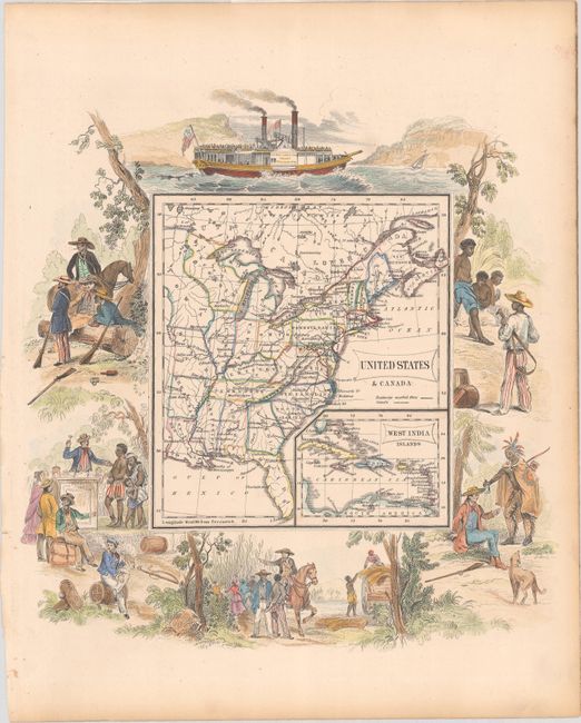
Subject: Eastern United States & Canada

Period: 1853 (published)

Publication: General Atlas

Color: Hand Color

Size:
9.8 x 10.4 inches
24.9 x 26.4 cm
Download High Resolution Image
(or just click on image to launch the Zoom viewer)

This is one of the more decorative 19th century maps to be found, and depicts the United States extending to the Mississippi River surrounded by images of slavery. Although this map was published in 1853, it shows large Iowa and Wisconsin Territories, despite the fact that Iowa and Wisconsin had been admitted as states in 1846 and 1848. Rivers, railways, canals, and a few cities are featured in each state. A small inset depicts the Caribbean. The vignettes surrounding the map include a slave auction, frontiersmen with rifles, a plantation owner ordering slaves in the field, a Native American Indian offering a bottle to a settler, and a Philadelphia steamship.

References:

Condition: A

Marginal toning and remnants of hinge tape on verso.

Estimate: $200 - $250

Sold for: $160

Closed on 4/28/2021

Archived