Catalog Archive
Auction 182, Lot 107

French Edition of Popple's Index Sheet

"Amerique Septentrionale Suivant la Carte de Pople Faite a Londres en 20 Feuilles", Popple/Le Rouge

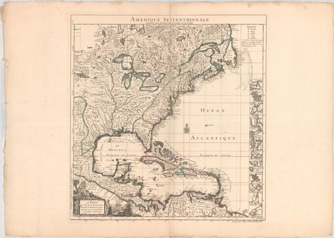
Subject: Colonial North America & West Indies

Period: 1742 (dated)

Publication:

Color: Hand Color

Size:
19.1 x 20.3 inches
48.5 x 51.6 cm
Download High Resolution Image
(or just click on image to launch the Zoom viewer)

This is the handsome index sheet of the French version of Henry Popple's important map of the British Empire in North America. Popple's 20-sheet map is the finest and most detailed map of America of its time and covers the eastern part of North America between the Mississippi and Newfoundland and the adjoining regions of Central and South America and the Caribbean. The index sheet is a reduced version of the multi-sheet map and includes a panel containing 18 plans of prominent ports, harbors and islands including Cartagena, Charleston, Bermuda, New York City, and Boston. As tensions grew between the colonial powers, Popple's map became immensely influential throughout Europe and was copied by several cartographers. This French version exaggerates French territory at the expense of both England and Spain.

References: McCorkle #742.2.

Condition: A

A crisp impression on a watermarked sheet with an archivally repaired short edge tear at bottom right that just enters the border. There are minor edge chips and tears along the sheet edges, far from the map image.

Estimate: $2,200 - $2,500

Sold for: $1,600

Closed on 4/28/2021

Archived