Catalog Archive
Auction 182, Lot 100

"[Lot of 2] Amerique Septentrionale [and] North America",

Subject: North America

Period: 1830-48 (dated)

Publication:

Color: Hand Color

Size:
See Description
Download High Resolution Image
(or just click on image to launch the Zoom viewer)
The United States and Great Britain established in 1818 joint claim over the Oregon Territory - the region north of Spanish controlled Upper California up to the southern boundary of Russia's Alaska Territory at North latitude 54°40'. By the late 1830's this arrangement was beginning to fall apart. In the 1840's the expansionist Democrats, including their 1844 presidential candidate, James Polk, claimed the entire region for the United States. Their expansionist desires were expressed by Polk's famous campaign slogan, "Fifty-four Forty or Fight!" The slogan also became a rally cry for Americans desiring to settle the territory. Following Polk's election, the dispute was resolved by the 1846 Treaty of Oregon, which struck a compromise that fixed the U.S./Canadian boundary at 49º North.

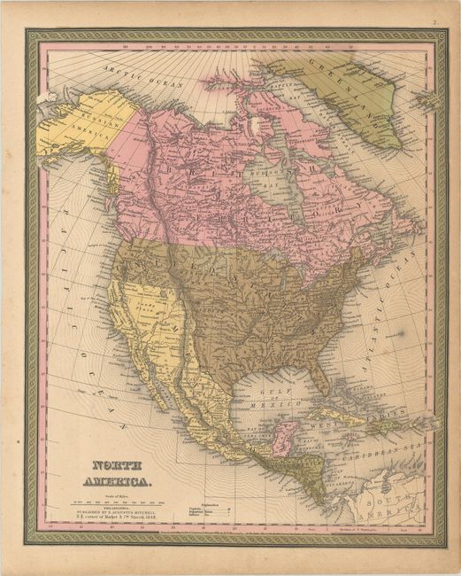
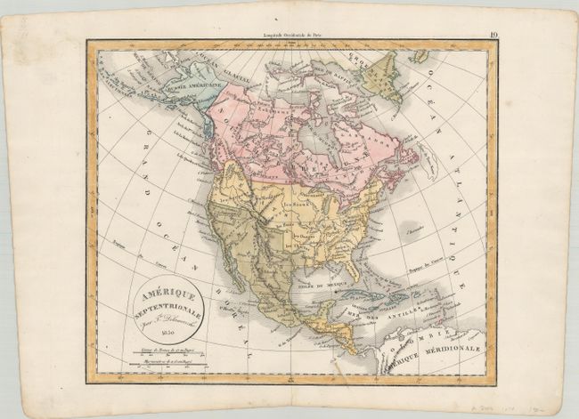
These maps illustrate North America during thwo important decades of the 19th century. During this period expansionist competition between the United States, Britain, Spain, and the Russian Empire dominated the western part of the continent and various expeditions expanded geographic knowledge.

A. Amerique Septentrionale, by Felix Delemarche, dated 1830 (12.9 x 10.9"). This simple map illustrates the French view of the continent. It shows the United States border extending well into present-day British Columbia, reflecting the Oregon Boundary Dispute. Alaska is labeled Russie Americaine with defined eastern borders. Much of the west is left blank or "inconnues" (unknown) and a note states that the lakes Timpanogos and Teguayo are doubtful. Condition: Light soiling almost entirely concentrated to the blank margins. (A)

B. North America, by Samuel Augustus Mitchell, from Universal Atlas, dated 1848 (12.8 x 15.6"). Great transitional map showing political boundaries within that short time period after the Oregon Boundary Dispute settlement and just prior to the resolution of the Mexican-American War. Texas is part of the United States, the U.S. controls Oregon Territory, but Mexico owns all of the Southwest. This example registered by H.N. Burroughs in 1846, with Mitchell's imprint below the title and dated 1848. Condition: Contemporary color on a lightly toned sheet with minor scattered foxing. (B+)

References:

Condition:

See description above.

Estimate: $200 - $230

Sold for: $150

Closed on 4/28/2021

Archived