Catalog Archive
Auction 181, Lot 96

Early Map of Vancouver

"Map of New Westminster District B.C. ", U.S. Government

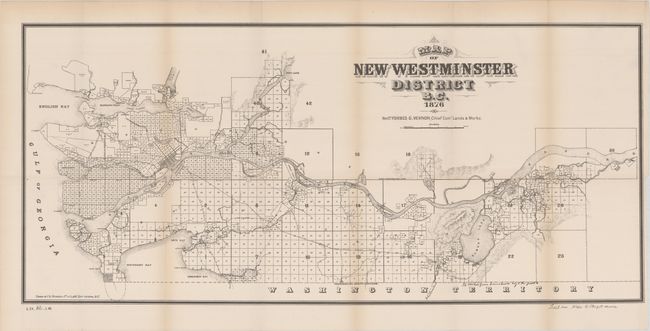
Subject: Vancouver, Canada

Period: 1876 (dated)

Publication: Sen. Ex. Doc. 62, 48th Congress, 1st Session

Color: Black & White

Size:
29.9 x 13.5 inches
75.9 x 34.3 cm
Download High Resolution Image
(or just click on image to launch the Zoom viewer)

This edition of Richard's map was included in an 1884 U.S. Congressional report demonstrating how easily Chinese emigrants could cross illegally into the U.S. from British Columbia. The map depicts the town and street grid pattern of New Westminster along the western bank of the Fraser River. It was the largest city in the Colony of British Columbia until superseded by Vancouver, here shown as the settlement of Granville, after the site was selected as the western terminus of the Canadian Pacific Railway and incorporated as Vancouver in 1886. There are no past sales records and only one institutional listing on OCLC.

References:

Condition: A

Issued folding with a hint of toning along the fold lines and sheet edges.

Estimate: $200 - $250

Sold for: $425

Closed on 2/10/2021

Archived