Catalog Archive
Auction 181, Lot 740

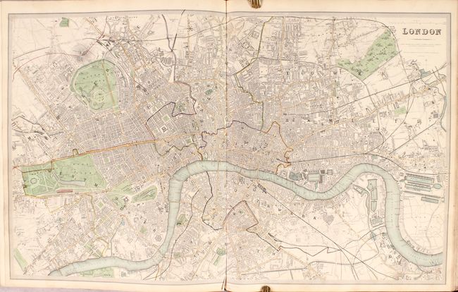
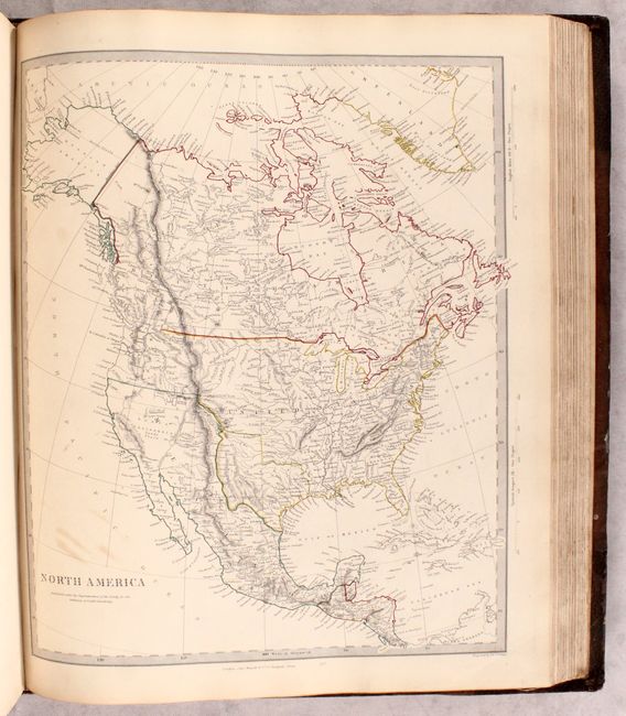
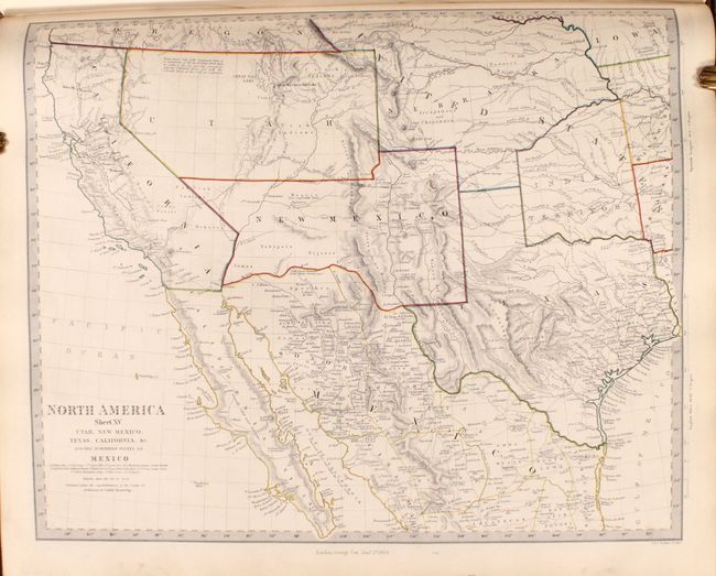
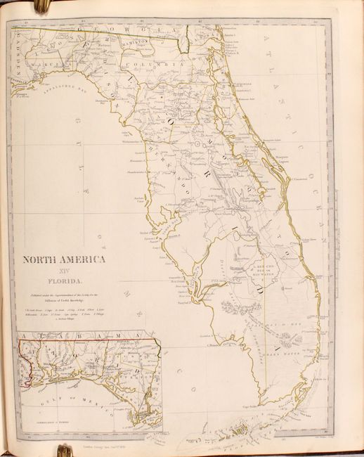
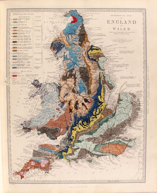
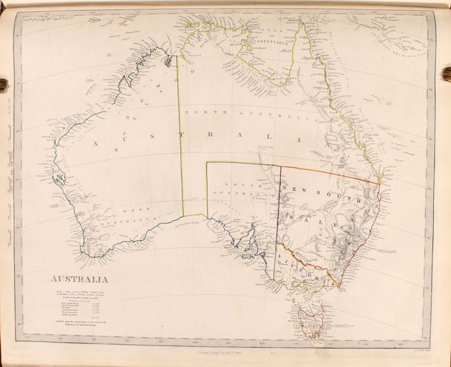
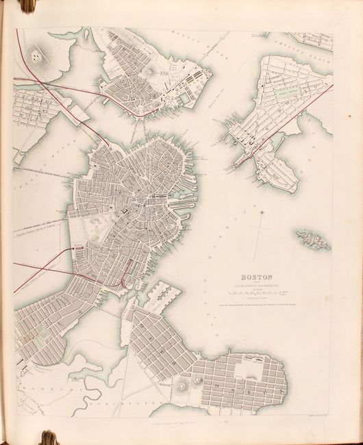
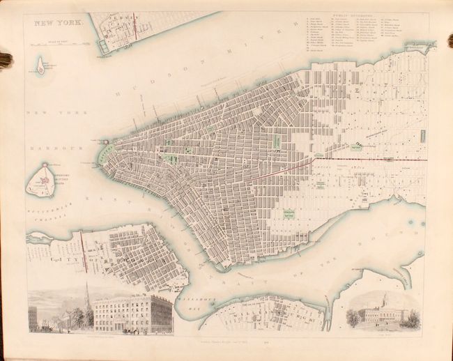
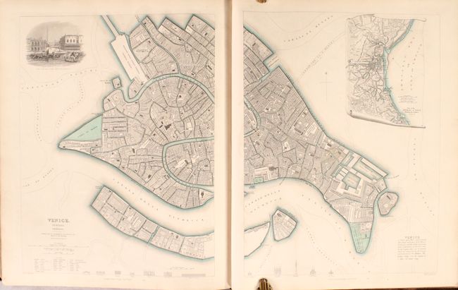
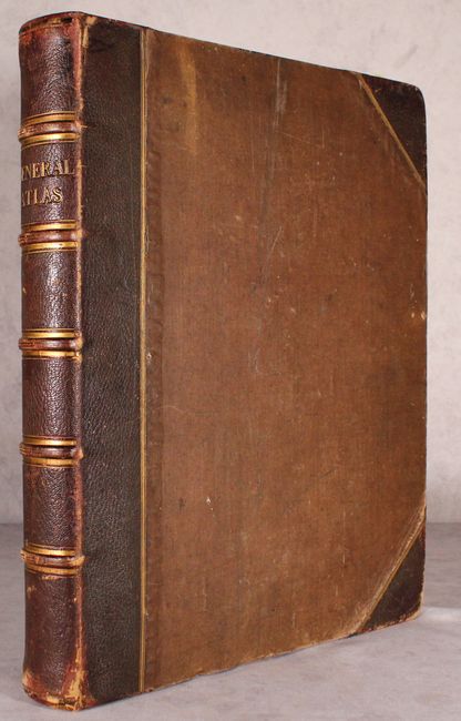
Rare, Complete 2-Volume Atlas with 221 Maps, Including 52 City Plans

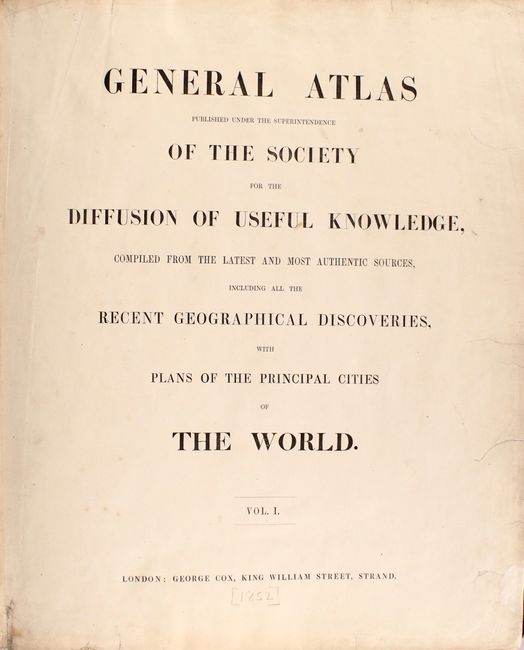
"General Atlas Published Under the Superintendence of the Society for the Diffusion of Useful Knowledge, Compiled from the Latest and Most Authentic Sources...", SDUK Society for the Diffusion of Useful Knowledge

Subject: Atlases

Period: 1852 (circa)

Publication:

Color: Hand Color

Size:
14.6 x 17.6 inches
37.1 x 44.7 cm
Download High Resolution Image
(or just click on image to launch the Zoom viewer)

The beginning of the nineteenth century saw a period of rapid market growth and innovation in the map publishing world. Increased literacy and public interest in new frontiers and colonies overwhelmed the market because it was oriented toward the small, affluent market of the previous century. With the intent to fill this void, The Society for the Diffusion of Useful Knowledge (SDUK) was founded in 1828 in London, by Lord Brougham and a group of men dedicated to the education of the aspiring working class and the Utilitarian ideal of 'Knowledge is Power.' The society produced an array of education materials, but the series of maps was one of their most successful ventures. A number of engravers and printers were used to produce the maps, which eventually exceed 200 sheets, and continued to be published after the Society as a whole ceased to function.

This atlas is two volumes bound into one and includes 221 single-page map plates (some of which combine to form multi-sheet maps) of every region around the world. Included are 12 maps of the world, 6 star charts, 21 of North America, 7 of South America, 31 of Asia, 13 of Africa, 70 of Europe, 4 of Australia and New Zealand, 4 of the oceans, and a chart of the rivers of the world. Also included are 52 plans of cities around the world from Amsterdam to Warsaw, many of which include panoramic views and vignettes of important buildings and sites, making them some of the most desirable 19th century city plans. The plans of London, Paris and Venice are two-sheet plans. Each volume begins with a title page and list of contents, and an index to place names is included at back. The volumes are complete.

The map of North America depicts the Southwest prior to Mexico losing the region in the Mexican/American War and an Independent Texas. The boundary between Canada and the United States is left incomplete, leaving the ownership of Oregon Territory (here labeled Columbia) unknown, which is unusual for a British map. Filled with well-developed topography, the map names numerous forts, trading posts, Indian tribes, and locates L. Youla roughly near the Great Salt Lake with the American Fur Depot on its eastern shore. The R. Buenaventura extends to the Pacific from two branches, one originating from a large swamp in the Great Basin. The course of the Snake River is fairly accurate, but the Colorado River originates too far north and rushes to the Sea of Cortez in a straight line. Locates the 3 buttes in present-day Idaho -- important landmarks on the Oregon Trail.

Another noteworthy map is that of the Southwest, which shows a large Utah Territory occupying the areas of present-day Nevada and Utah while New Mexico Territory encompasses the area from the Texas border to California, including the southern tip of Nevada. The southern border of New Mexico Territory is along the Gila River, showing the boundary with Mexico pre-Gadsden purchase. The map is filled with detailed topography, rivers, Indian tribes and place names. A note in the Great Basin states that "there is a succession of Rivers & Lakes which have no outlet to the sea, nor any connection with the Columbia River…"

Hardbound in quarter maroon leather with tips over brown cloth-covered boards. Spine has five raised bands and gilt titling and tooling. (Read our article about the SDUK here.)

References:

Condition: A

Maps have contemporary hand color and are generally very clean and bright with minor toning along the edges of the sheets and occasional spots of soiling, mostly confined to the blank margins. The two-sheet plan of London has a long centerfold separation. The table of contents and title page are soiled with several edge tears; the title page has been professionally backed in thin tissue to repair the chips and tears. The hinges are starting and the covers are moderately worn with some scuffing, soiling, and bumped corners, but are still in very sturdy condition.

Estimate: $7,000 - $8,500

Sold for: $4,500

Closed on 2/10/2021

Archived