Catalog Archive
Auction 181, Lot 605

NO RESERVE

"[Lot of 2] A Map of Media [and] Carte de la Perse avec ses Dependances",

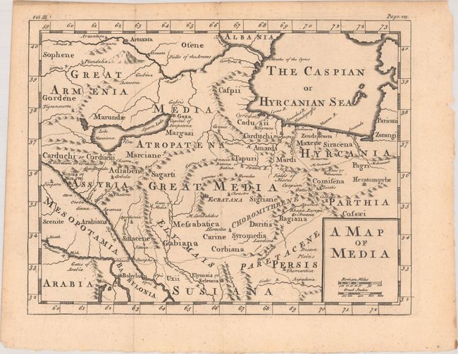
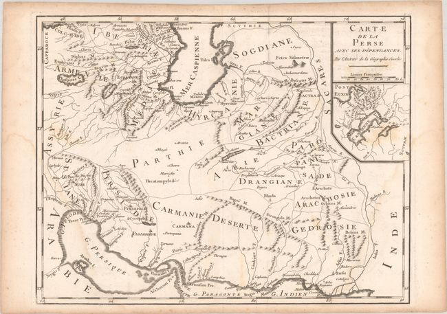
Subject: Persia - Iran

Period: 1750-1801 (circa)

Publication:

Color: Black & White

Size:
See Description
Download High Resolution Image
(or just click on image to launch the Zoom viewer)

A. A Map of Media, by Anonymous, circa 1750 (10.9 x 8.4"). This handsome map centers on the historical region of Media in present-day northern Iran and Azerbaijan. It names nearby historical regions including Armenia, Assyria, Mesopotamia, Babylonia, Parthia, and Hyrcania. There is nice topographical detail, especially of the region's rivers and mountains. "Vol. III." and "Page 223" appear above the neatline. Condition: A nice impression issued folding with a couple of minor spots of foxing. (A)

B. Carte de la Perse avec ses Dependances, by Joseph-Romain Joly, from Atlas de l'Ancienne Geographie Universelle..., published 1801 (13.4 x 10.3"). This very uncommon map of the Persian Empire is from Joly's book on ancient geography. Ancient place names appear throughout the map. An inset map beneath the title cartouche focuses on the Caucasus. Condition: A sharp impression on watermarked paper with light dampstains, minor scattered foxing, and some slight creasing. (B+)

References:

Condition:

See description above.

Estimate: $70 - $90

Sold for: $65

Closed on 2/10/2021

Archived