Catalog Archive
Auction 181, Lot 36

"Tabula Geographica Hemisphaerii Australis ad Emendatiora quae Adhuc Prodierunt Exempla...", Rhode, Johann Cristoph
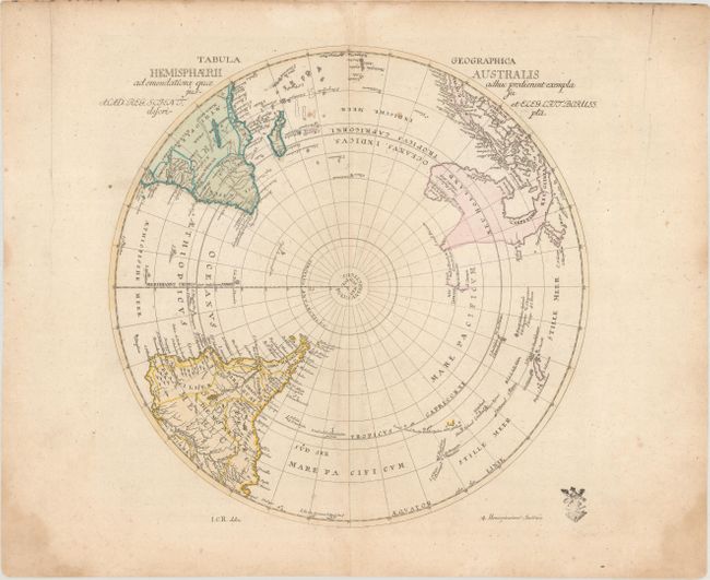
Subject: South Pole

Period: 1753 (circa)

Publication: Atlas Geographicus...

Color: Hand Color

Size:
11.9 x 12 inches
30.2 x 30.5 cm
Download High Resolution Image
(or just click on image to launch the Zoom viewer)

This interesting and uncommon polar map shows cartographic misconceptions in the South Pacific, with Australia still connected to Tasmania and New Guinea. New Zealand is only partially delineated. Johann Cristoph Rhode (1713-1786) was an active publisher in Berlin during the 1740s and 50s and is best known for his important French and Indian War maps. This map was prepared for the Royal Prussian Academy of Sciences and was published in Leonhard Euler's Atlas Geographicus. The customary Prussian privilege seal is shown at lower right.

References:

Condition: B+

A nice impression on a sheet with the watermarks of "Hallo" and a large fleur-de-lis coat of arms. There is light soiling and some damp stains confined to the far edges of the sheet.

Estimate: $200 - $230

Sold for: $210

Closed on 2/10/2021

Archived