Catalog Archive
Auction 181, Lot 257

"Plan de la Nouvelle Orleans", Bellin, Jacques Nicolas

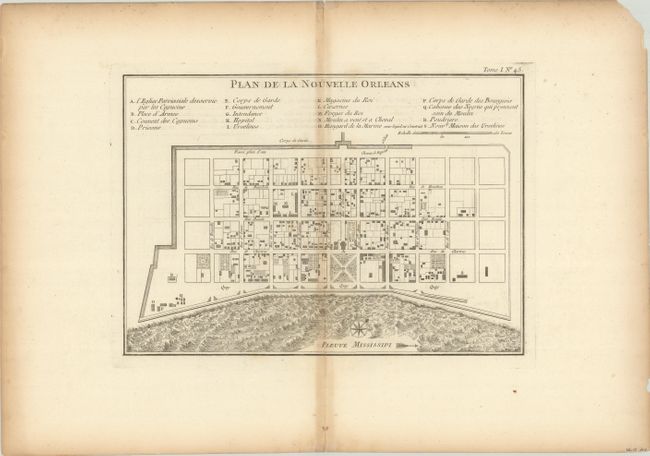
Subject: New Orleans, Louisiana

Period: 1764 (circa)

Publication: Le Petit Atlas Maritime

Color: Black & White

Size:
11.6 x 8.1 inches
29.5 x 20.6 cm
Download High Resolution Image
(or just click on image to launch the Zoom viewer)

This attractive copper-engraved plan of the city of New Orleans details the city center including Bourbon Street. Individual buildings are depicted and keyed to a list under the title naming 18 buildings. The plan locates the quay along the Mississippi River, the canal, government buildings, a church, a prison, a hospital, a monastery, and Army and Navy quarters. Bellin's plan was first issued in Charlevoix's History and General Description of New France in 1742 with later versions, such as this, used in several publications. The plan became the standard map of New Orleans throughout the eighteenth century.

References: Lemmon, Magill & Wiese #171.

Condition: B+

On watermarked paper with light toning along the centerfold and sheet edges. A short centerfold separation confined to the bottom blank margin has been closed on verso with archival tape.

Estimate: $375 - $450

Sold for: $350

Closed on 2/10/2021

Archived