Catalog Archive
Auction 181, Lot 20

Map Depicting Oceanic Mountain Ranges

"Planisphere Suivant la Projection de Mercator. Elemens de Geographie Moderne a l'Usage des Colleges et Maisons d'Education...", Fremin, A. R.
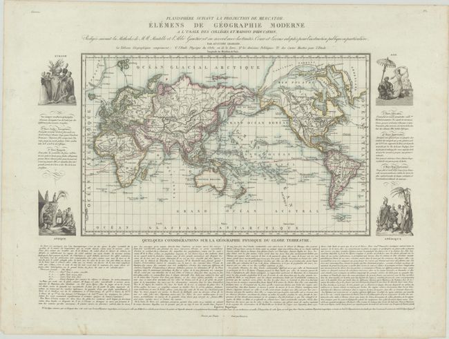
Subject: World

Period: 1830 (circa)

Publication:

Color: Hand Color

Size:
18.6 x 15 inches
47.2 x 38.1 cm
Download High Resolution Image
(or just click on image to launch the Zoom viewer)

This world map by Augustin Legrand was created for schools and "houses of education," with a focus on mountain ranges and river systems. Of cartographic interest is the portrayal of the Arctic regions, with a Continent Suppose extending from Greenland to the Bering Strait. Also notable are the depictions of oceanic mountain ranges, many decades before ocean floor surveys were conducted. Vignettes of people from the four continents flank the map, along with descriptions of the five principal races of the world: Arab/European, Mongol, African, American, and Hyperborean. At bottom are extensive notes on the physical geography of the world. Drawn by Fremin and engraved by Barrierre.

References:

Condition: A

A crisp impression on a bright sheet with a bunch of grapes watermark and minor toning and soiling along the edges of the sheet.

Estimate: $400 - $475

Sold for: $250

Closed on 2/10/2021

Archived