Catalog Archive
Auction 181, Lot 181

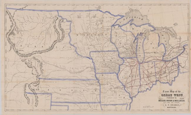
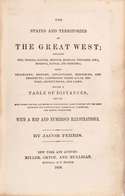
"A New Map of the Great West [with] The States and Territories of the Great West",

Subject: Central United States

Period: 1856 (published)

Publication:

Color: Hand Color

Size:
25 x 14.7 inches
63.5 x 37.3 cm
Download High Resolution Image
(or just click on image to launch the Zoom viewer)

This uncommon map was published by Miller, Orton & Mulligan, New York & Auburn. It was drawn by E. F. Beadle of Buffalo. The map shows all of Ohio, Michigan, Wisconsin, Indiana, Illinois, Missouri, Iowa, and the enlarged territories of Minnesota and Kansas, each neatly outlined in blue watercolor. In today's Colorado, Denver does not appear, but Canon, Fort St. Vrain, Pueblo and Fort Lancaster are named. It shows the huge, nebulous Nebraska Territory (created in 1854), west of Minnesota and north of Kansas. Kansas Territory extends to the Rocky Mountains and includes the regions allocated to the Arapahos & Cheyennes. Indian Territory is indicated for the Cherokees. Original red coloring shows railroad detail extending west to Iowa City. The map has fancy titling and includes details of watershed, villages and forts, and with rudimentary information on the Rocky Mountains. Laid in the complete volume The States and Territories of the Great West by Jacob Ferris. Octavo, hardbound in original tan cloth with gilt pictorial stamping on cover and spine. 352 pages, 4 pages of advertisements, several b&w plates and folding frontispiece map.

References: Wheat (TMW) #885; Wagner-Camp #274A.

Condition: B+

The folding map is very good with a bit of minor foxing and a binding tear at right that has been closed on verso with archival tape. Text is mostly clean and bright with occasional foxing. Covers are lightly worn with bumped corners.

Estimate: $300 - $375

Sold for: $450

Closed on 2/10/2021

Archived