Catalog Archive
Auction 181, Lot 12

"A New Map of the Whole World with the Trade Winds According to ye Latest and Most Exact Observations", Moll, Herman
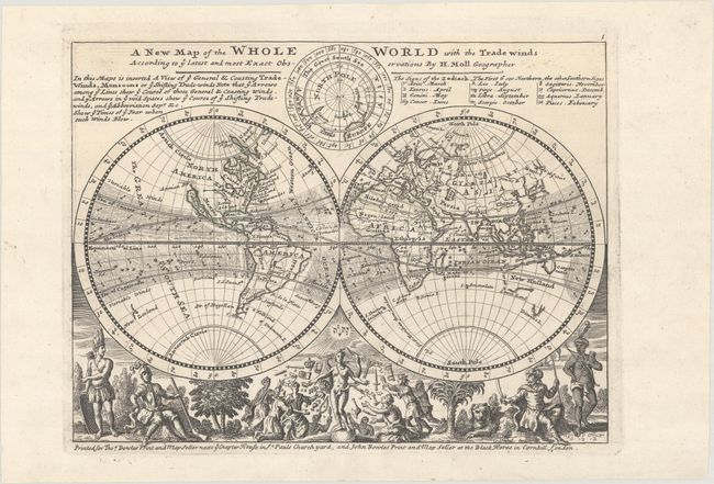
Subject: World

Period: 1732 (circa)

Publication:

Color: Black & White

Size:
10.3 x 7.8 inches
26.2 x 19.8 cm
Download High Resolution Image
(or just click on image to launch the Zoom viewer)

Very nice map with California as an island. Northwestern North America is largely left blank, with Annian Str. appearing north of California. The eastern seaboard is labeled as the English Empire. Northeast Asia is only partially delineated, with a note in northern Russia that reads, "Parts Unknown." The borders of Australia and Tasmania are incomplete. Above the hemispheres is a north polar projection. The bottom is filled with unusual male representations of the continents and other interesting allegorical scenes. This early thematic map uses arrows to depict the trade winds and their directions. A note at top discusses trade winds and monsoons and incorporates a list of the zodiac signs. Imprint below bottom neatline notes that the map was printed for Thos. Bowles Print and Map Seller next ye Chapter House in St. Pauls Churchyard, and John Bowles Print and Map Seller at the Black Horse in Cornhill, London.

References: Shirley (BL Atlases) T.MOLL-9b #1; Phillips (Atlases) #585-1.

Condition: A+

A fine example with dark impression on a clean sheet.

Estimate: $475 - $600

Sold for: $375

Closed on 2/10/2021

Archived