Catalog Archive
Auction 181, Lot 126

"[Reproduction] North America West Coast Haro and Rosario Straits Surveyed by Captn. G.H. Richards & the Officers of H.M.S. Plumper 1858-9, the Shores of Juan de Fuca Strait to Admiralty Inlet from Captn. H. Kellett’s Survey, 1847…", British Admiralty

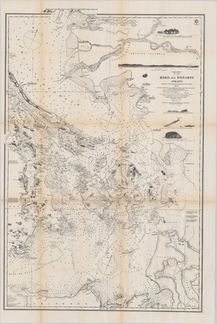
Subject: Washington, British Columbia

Period: 1872 (circa)

Publication:

Color: Black & White

Size:
22.8 x 34.2 inches
57.9 x 86.9 cm
Download High Resolution Image
(or just click on image to launch the Zoom viewer)

This is a reproduction of an earlier 1859 chart by Captain Richards used in the British presentation in the Berlin Arbitration that settled the boundary dispute over San Juan Island that had precipitated the Pig War of 1859. The chart depicts the Strait of Juan de Fuca, Strait of Georgia, the southern tip of Vancouver Island, and the San Juan Islands. Includes numerous depth soundings, banks, magnetic variation, four coastal approaches, and more. This is an example of the process of photozincography the British Ordnance office had recently developed.

References:

Condition: B+

Issued folding with light toning along the fold lines and a few small fold separations that have been closed on verso with archival tape.

Estimate: $160 - $190

Sold for: $140

Closed on 2/10/2021

Archived