Catalog Archive
Auction 180, Lot 91

One of the Earliest Maps to Name the United States

"Carte du Mexique et des Etats Unis d'Amerique, Partie Meridionale. Dressee sur un Grand Nombre de Memoires...", Delisle/Dezauche

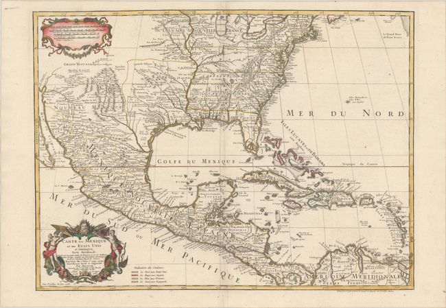
Subject: Colonial Eastern North America & West Indies

Period: 1783 (dated)

Publication:

Color: Hand Color

Size:
25.5 x 18.9 inches
64.8 x 48 cm
Download High Resolution Image
(or just click on image to launch the Zoom viewer)

The title of this map contains a very early recognition of the newly formed United States, as 1783 is the earliest that the name appears on a printed map. This is the last issue of Delisle's map that was first issued in 1703 with the title Carte du Mexique et de la Floride. Delisle's map is regarded as the first map to correctly show the course of the lower Mississippi, to accurately place the Great Lakes, and to locate many English coastal settlements. Its longevity and numerous copies by other mapmakers attest to the importance of this engraving. Dezauche was Buache's son-in-law, and the successor to the Delisle business. In Dezauche's edition the original title on the map was altered to include the words Etats Unis and also a legend with color-coding were added to show the colonial possessions of England, France, Spain and the extent of the United States.

References: Tooley (Amer) p.22 #53; cf. Cumming (SE) #137; Martin (TX) p.92-3.

Condition: A

A crisp impression on a watermarked sheet.

Estimate: $1,200 - $1,500

Sold for: $900

Closed on 11/18/2020

Archived