Catalog Archive
Auction 180, Lot 204

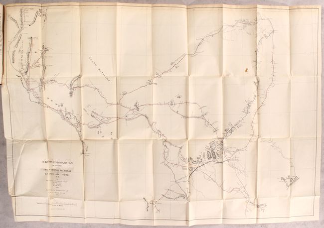
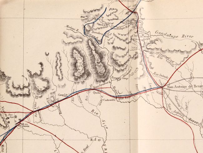
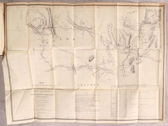
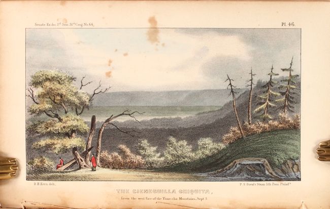
"[2 Maps in Report] Reconnaissances of Routes from San Antonio de Bexar to El Paso del Norte &c. &c. [and] Map of the Route Pursued in 1849 by the U.S. Troops, Under the Command of Bvt. Lieut. Col. Jno. M. Washington, Governor of New Mexico...", U.S. War Department

Subject: Southwestern United States

Period: 1850 (published)

Publication: Sen. Ex. Doc. 64, 31st Congress, 1st Session

Color: Hand Color

Size:
6 x 9 inches
15.2 x 22.9 cm
Download High Resolution Image
(or just click on image to launch the Zoom viewer)

This congressional volume contains the 250 page Reports of the Secretary of War including reconnaissances by Johnston, Smith, Bryan, Michler, Whiting, and others. Of particular interest are the following maps:

A. Reconnaissances of Routes from San Antonio de Bexar to El Paso del Norte &c. &c. (36.3 x 24.6"). This map covers the region of Texas between the Rio Grande at left and east to include Matagorda Bay, Preston and Fort Washita. There is good detail along routes, especially around San Antonio de Bexar, and mostly blank elsewhere. Shows a reconnaissance of 1849 in red and Lt. Whiting's route in blue. It is filled with geographical information, forts, presidios, springs, fords, watering holes and much more. Mostly uncolored save for fine coloring along the routes.

B. Map of the Route Pursued in 1849 by the U.S. Troops, Under the Command of Bvt. Lieut. Col. Jno. M. Washington, Governor of New Mexico, in an Expedition Against the Navajos Indians, by Simpson/Kern (27.5 x 20.3"). This important map led to the opening up of the region to travel and settlement. It was the product of a punitive expedition against marauding Navajo Indians. The expedition traveled from Santa Fe to Jemez Pueblo, then on the Navaho trail to Chaco Canyon, and via Washington Pass to Canyon de Chelly. They engaged the Navajo in their strongholds at Chaco Canyon and Canyon de Chelly where the tribe was soundly defeated. The soldiers then explored the area and were the first white men to discover and describe the prehistoric pueblos in the region. The return route traveled south of the Zuni Pueblos and east past Inscription Rock and Laguna Pueblo to the Rio Grande. A seldom seen map that Wheat calls "an arresting production, bringing out many new details of the region." Also mostly uncolored except for along the routes.

Included within these reports are 72 plates of illustrations with the Kern plates being some of the earliest executed in color in a government report. Other reports in the thick octavo volume include Gurley’s report on Liberia with a folding map and plates along with Webster’s report of a survey of the mouth of the Rio Grande. Hardbound in full contemporary leather with gilt title labels on spine.

An important report with two excellent maps on the exploration that opened western Texas to settlement.

References: Wagner-Camp #184; Wheat (TMW) #641 & #677.

Condition: B+

The two folding maps are very good with even light toning and some extraneous creasing at lower left. Other plates and text have light scattered foxing. The front hinge is starting, the spine is cracked, and the covers have average shelf wear.

Estimate: $500 - $650

Sold for: $300

Closed on 11/18/2020

Archived