Catalog Archive
Auction 180, Lot 194

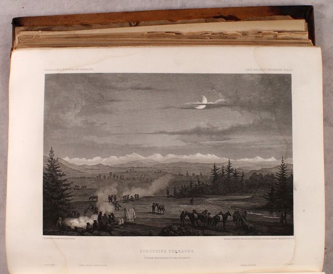
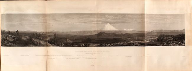
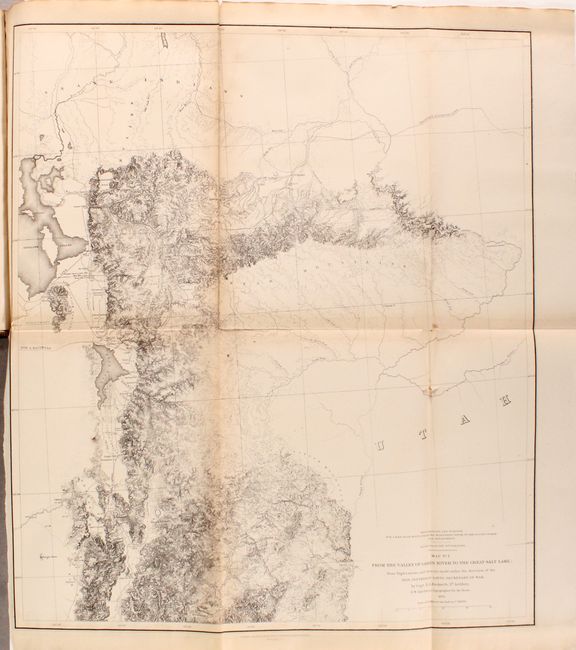
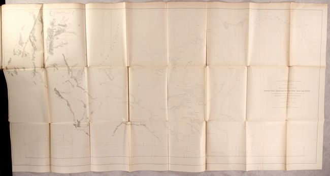
"Reports of Explorations and Surveys, to Ascertain the Most Practicable and Economical Route for a Railroad from the Mississippi River to the Pacific Ocean ... Volume XI", U.S. Railroad Surveys

Subject: Western United States

Period: 1855 (published)

Publication: Sen. Ex. Doc. 78, 33rd Congress, 2nd Session

Color: Black & White

Size:
9 x 12 inches
22.9 x 30.5 cm
Download High Resolution Image
(or just click on image to launch the Zoom viewer)

During the 1850s, the U.S. government sponsored an extensive series of expeditions designed to gather information on the vast new territories that had been acquired in western North America. The discovery of gold in California further stimulated westward traffic and heightened the need for a faster and more convenient way to bring the far-flung parts of the country together. In 1853 Congress commissioned the Army's Topographic Bureau to conduct a series of surveys to find a suitable route for a transcontinental railroad. There were six major expeditions; five of them covered the area between the Great Plains and west coast, and the sixth explored the coastal states of California and Oregon. All of these expeditions were accompanied by naturalists and artists to document the landscape, flora and fauna along the route. The reports, maps and lithographs were published in the 13 volume report "Explorations and Surveys to ascertain the most practicable and economical route for a Railroad from the Mississippi river to the Pacific Ocean."

This profusely illustrated volume includes Lieutenant Warren's Memoir along with numerous folding maps and plates issued in previous volumes of the Pacific Railroad surveys. This volume does not include "Warren's General Map," however it does include 20 of the 24 called for folding maps and 8 of 10 profiles including those from the reports of Stevens, Abbot, Beckwith, Whipple, Williamson, Parke, and Pope. Also having to do with the 41st Parallel survey, it includes the beautifully engraved plates and panoramas (13 of 13) from Lieut. Beckwith's explorations from Salt Lake City to the Sacramento River . Features the "Northern Slopes of the Sierra Nevada" which has a dramatic view of Mt. Shasta. Quarto, hardbound in contemporary leather with gilt title labels on spine.

References: Wagner & Camp #266c.

Condition: B

The maps are mostly good with scattered faint dampstains along the folds and in the blank margins. There are a number of small binding tears, a few separations, and four of the maps/profiles have significant tears or separations (Williamson's Map of Passes in Sierra Nevada and Tejon Pass, Beckwith's Green River to Great Salt Lake (repaired), as well as Parke's map of Pimas Villages to Fort Fillmore). Text and plates are bright with faint dampstains at top and bottom throughout. Covers are heavily worn and stained, and the spine is chipped at bottom.

Estimate: $250 - $325

Sold for: $220

Closed on 11/18/2020

Archived