Catalog Archive
Auction 179, Lot 526

"Hondius His Map of France", Hondius/Purchas
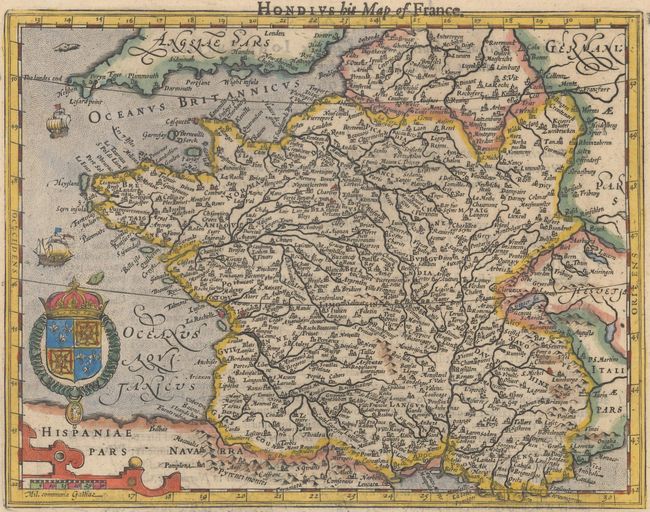
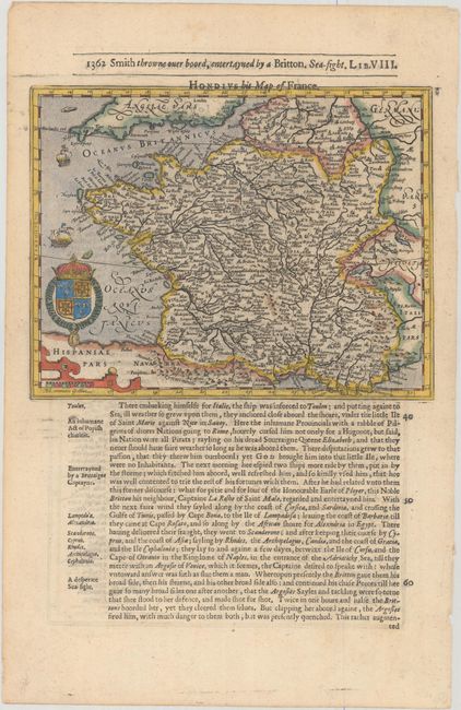
Subject: France

Period: 1625 (published)

Publication: Purchas His Pilgrimes...

Color: Hand Color

Size:
7.8 x 6 inches
19.8 x 15.2 cm
Download High Resolution Image
(or just click on image to launch the Zoom viewer)

Attractive small map of France showing major mountain ranges, rivers and cities. Adorned with the royal coat of arms and a strapwork distance scale cartouche. On a sheet of English text measuring 8.8 x 13.5".

At the beginning of the 17th century, Samuel Purchas, an English cleric, set out to publish a compendium of voyages to foreign countries. To illustrate his work, Purchase obtained the rights to use Jodocus Hondius' copperplates from Atlas Minor. Over 60 maps were included in Purchas His Pilgrimes, most of which were from Hondius' plates, with English titles inserted above them. Purchas also had a few additional maps engraved, including those for India, China, Greenland, North America, and Nova Scotia.

References: Shirley (BL Atlases) G.PUR-1a #31.

Condition: A

A dark impression on a clean sheet with a minor horizontal crease in southern France.

Estimate: $120 - $150

Sold for: $90

Closed on 9/16/2020

Archived