Catalog Archive
Auction 179, Lot 472

"Beschrijvinghe vande Zee Custen van Engelandt Tusschen Blacqneij en Scharenburch...", Waghenaer, Lucas Jansz

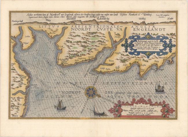
Subject: Eastern England

Period: 1585 (circa)

Publication: Spieghel der Zeevaerdt

Color: Hand Color

Size:
20.1 x 12.9 inches
51.1 x 32.8 cm
Download High Resolution Image
(or just click on image to launch the Zoom viewer)

This uncommon and very early sea chart covers the coast of England from Blakeney north to Scarborough. Soundings, anchorages, and other navigational information appear in the North Sea. Place names and some nice topographical detail are shown along the coast. Three vessels decorate the sea. A 32-point compass rose orients the north to bottom right. The title and distance scales are each enclosed by their own ornate cartouche. There is a profile view of the coast running across the top of the sheet. Waghenaer's charts are renowned for their fine engraving by the best craftsmen of the period including Theodore de Bry and the Doetecum brothers. This map was engraved by Joannes Doetecum. Latin text on verso.

References: Shirley (BL Atlases) M.WAG-1a.

Condition: A

A crisp impression on a clean sheet with two tiny wormholes in the image that have been closed on verso with archival materials.

Estimate: $1,400 - $1,700

Sold for: $950

Closed on 9/16/2020

Archived